Today was a travel day. We had another leisurely morning. We finished packing up and then drove to the campervan office to turn in the van. The return process was very quick and efficient. We took the shuttle to the airport. Luckily our suitcases were not overweight. Our flight was easy and uneventful. We had booked a hotel room near the airport for the night since we pick up our campervan tomorrow near the airport. We ubered to the hotel. It was weird to be in a hotel after living in the camper for two weeks.
We were going to go into Auckland for dinner but the uber was going to cost NZ$42, or over US$50 round trip which seemed a little too expensive so we stayed in the hotel and had dinner there. We watch CNN that evening to get caught up on the news.
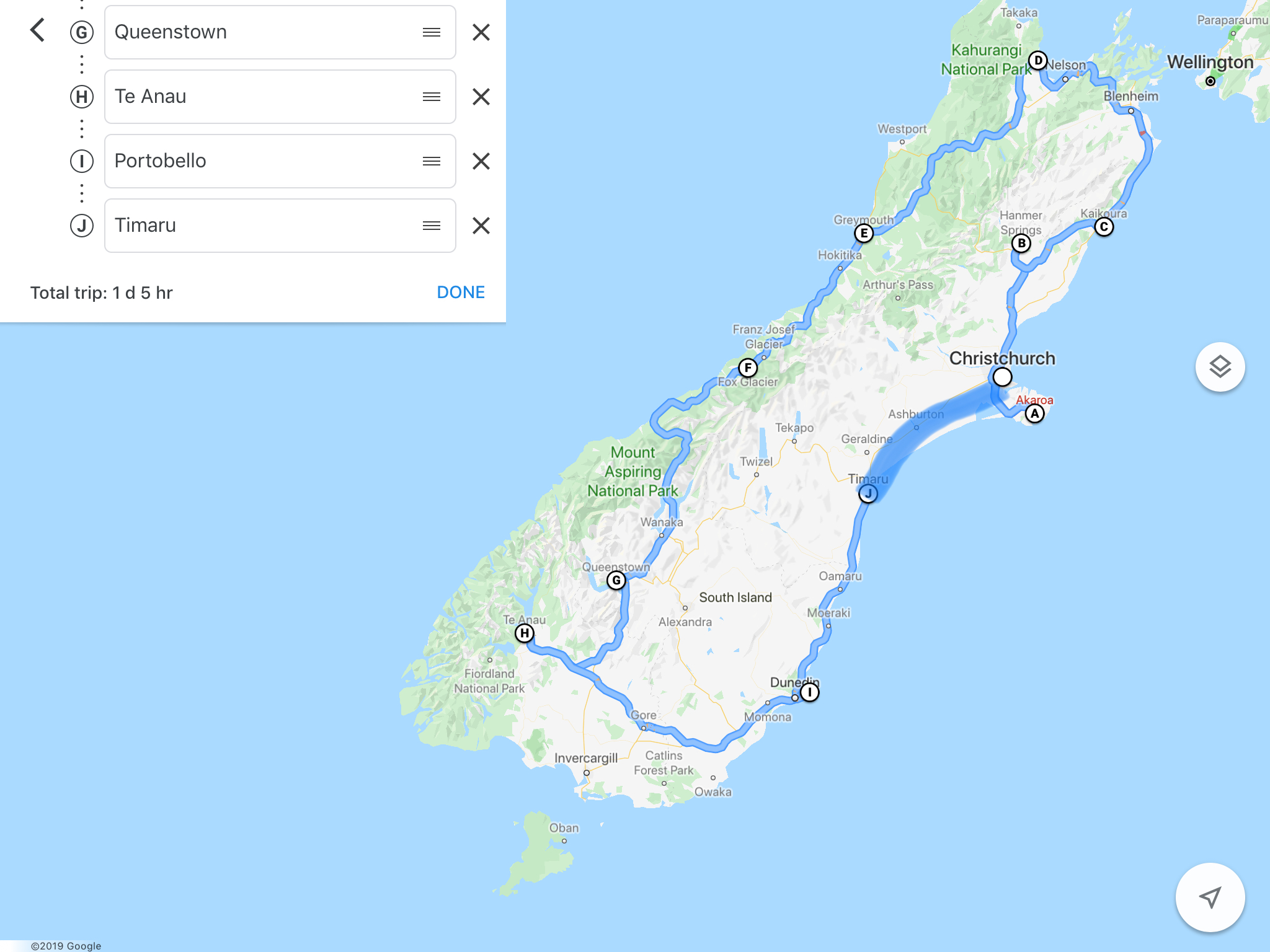
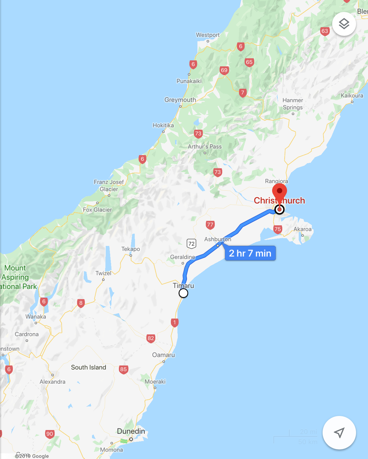
Here’s a map of our total route around the south island.
The last leg looks different because I had to draw it in (too many stops for google).
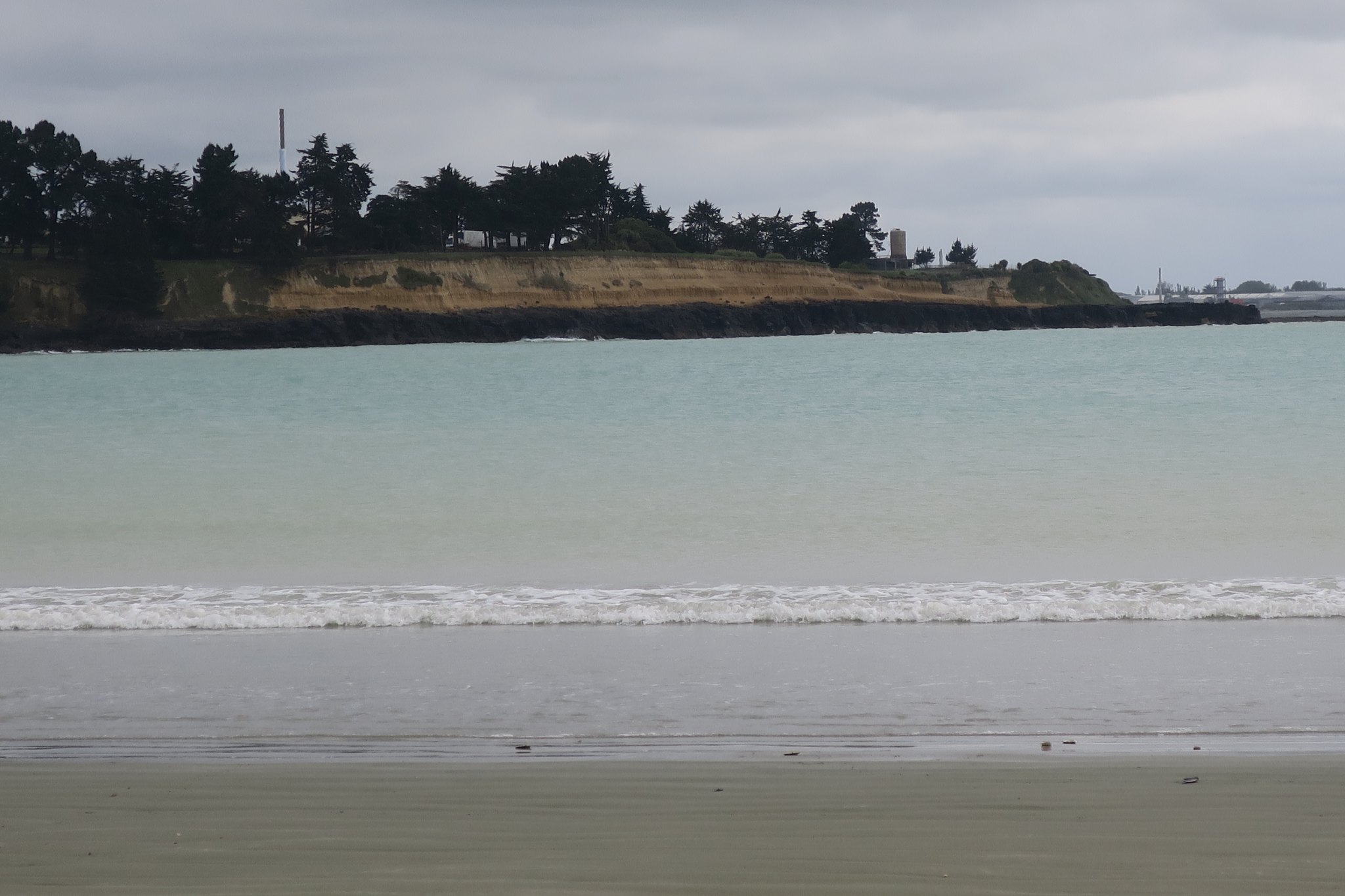
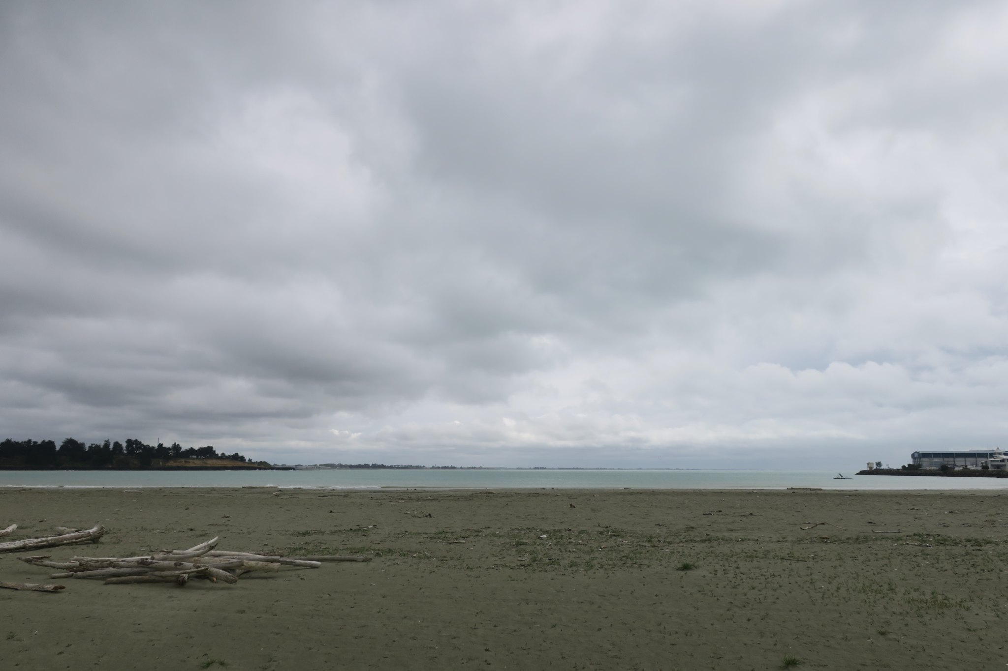
We had a leisurely morning. We don’t have any sightseeing planned and just have a two hour drive to Christchurch. We did laundry, took showers and Rick made eggs for breakfast. It rained overnight and the day started off overcast. We went to the Caroline Bay Beach in Timaru to have a look around but it was spitting so we didn’t stay long.
We left Timaru and headed to Christchurch. By now it was consistently raining. We turned off the main road onto to a scenic drive, very pretty pretty but the sights were similar to much of the east coast, fields of sheep, lambs, and cows. We had a nice lunch in a rest stop listening to the rain in our cozy van.
We arrived in Christchurch around 3. We went to the campervan office and picked up our suitcases. Then we drove to the campsite.
It was raining pretty hard so we stayed in the campervan, relaxed, worked on the blog and packed. For dinner we tried to finish up our food so Rick has a salad and I had chicken parmesan. We didn’t have much food left over but what we did have we put in the kitchen and hoped someone else would be able to use it.
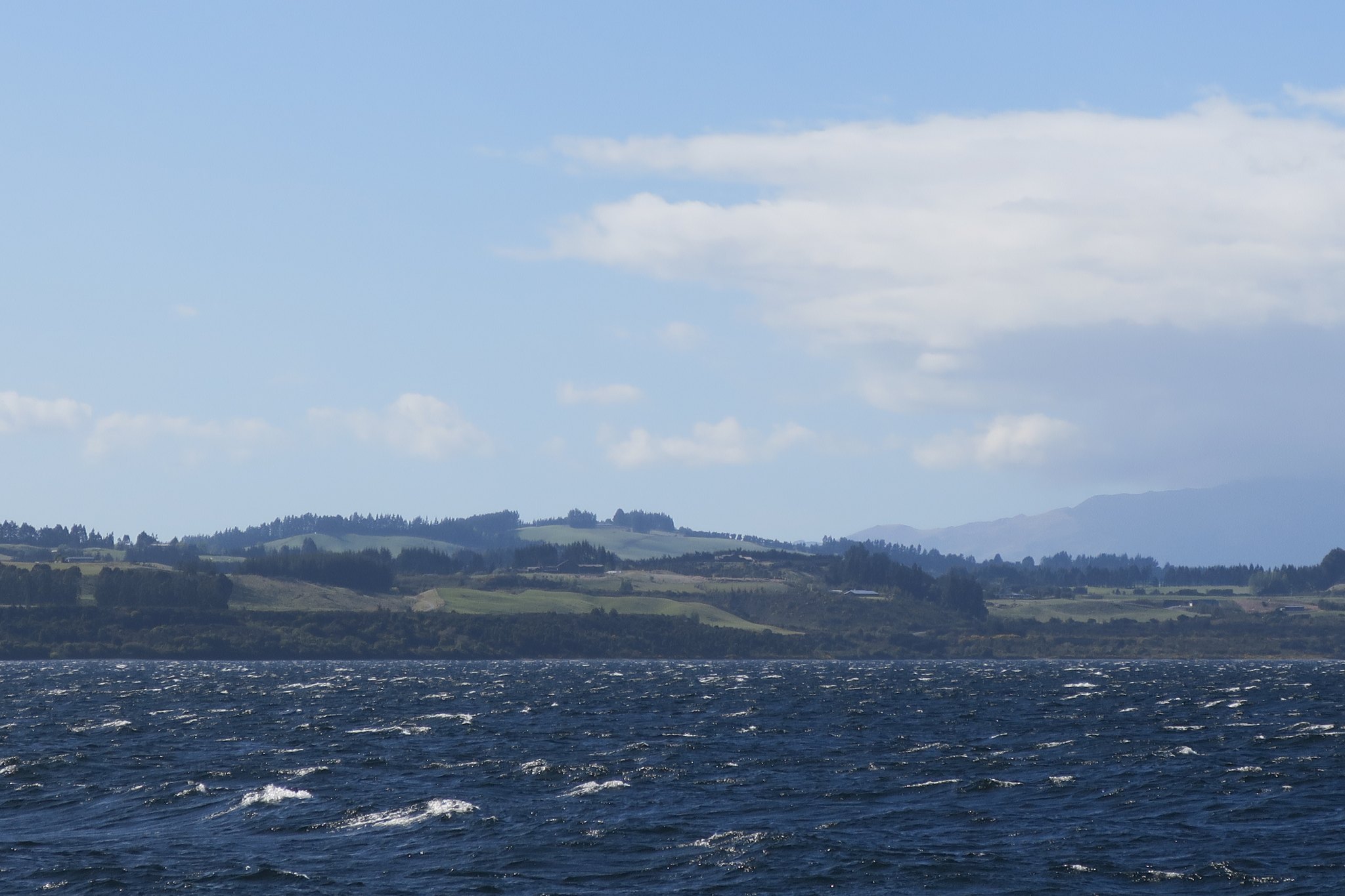
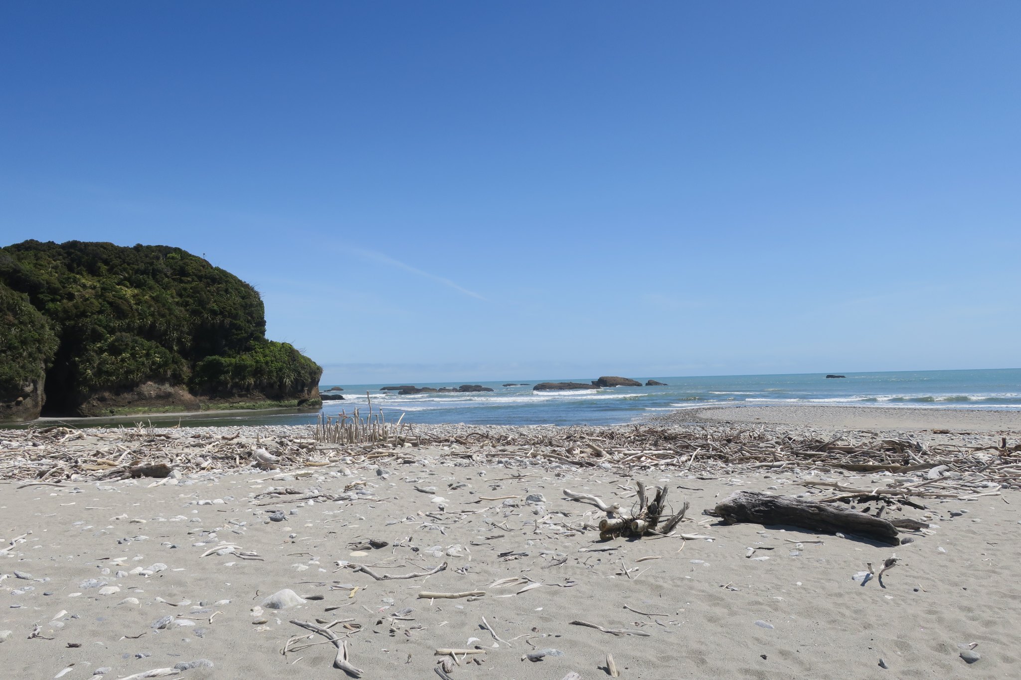
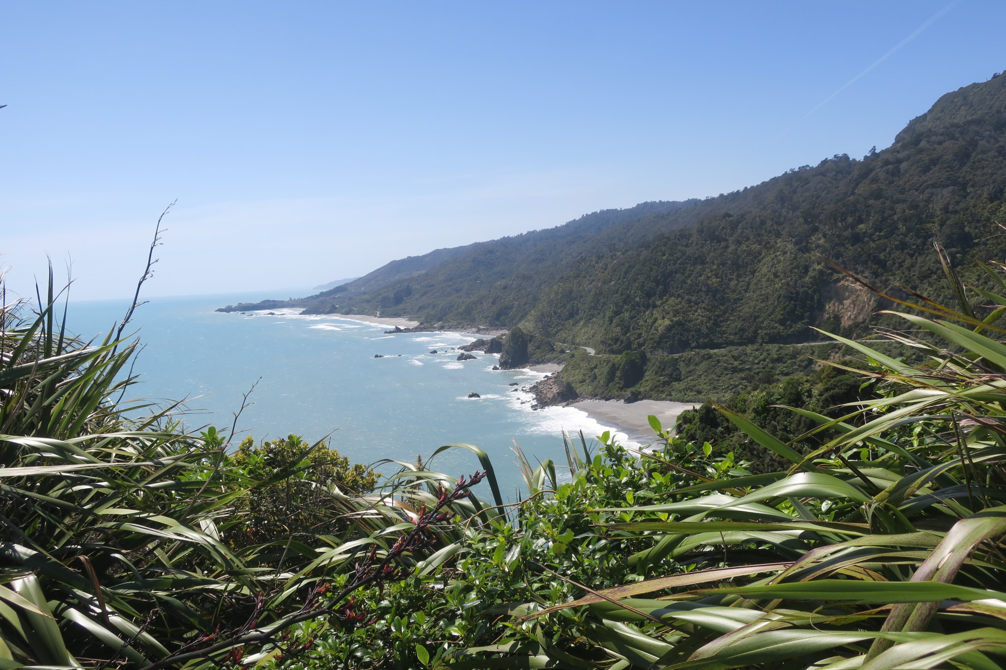
Unfortunately we left the campground this morning before Edward and Diane were up so we didn’t get to say goodbye. We traveled about 3 hours to Timaru. Along the way we were commenting that the east coast looks lot different than the west coast. The cities on the east coast are bigger and have more facilities. Generally on the west coast the roads wind along forests and up and over mountains. The east roads are lined with fields of grazing sheep and cattle. We drove along the ocean for a while and it is turquoise in color. In the Caribbean the water is turquoise because the bottom is sand but that’s not the case here. I asked about it and the guide told me it is because it is rich in plankton.
We stopped for some breakfast. I also got a pie. They seem to make dinner pies filled with a variety of fillings. I’ve wanted to try one so I got a steak, bacon, and cheese pie for dinner.
We got to Timaru around noon and checked in at the campground. Yesterday we purchased tickets to the Maori Rock Art museum. We haven’t been exposed much to the Maori culture so we wanted to take this opportunity to learn. In addition to viewing the exhibition our tickets included going to see the actual rock art. We were supposed to be at the museum at 2 but we received a call saying that the weather was changing and it would be good if we got there early, so we packed up and drove to the museum.
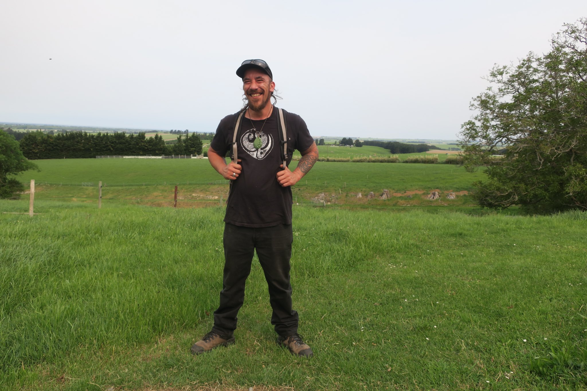
There we were greeted by Wesley, a Maori man in his 20s. He told us about the Maori people and their culture. Here are some of the things he told or we learned via the exhibitions
The Maori arrived in New Zealand somewhere between 700 and 1000 years ago. DNA suggests that they were a mix of various Polynesian backgrounds. He suggested they may have followed birds or whales to the islands.
They lived in small tribes on the North and South Islands. The tribes on the north island were more aggressive while those on the south were more cooperative with each other.
They live on fish, birds, and vegetables.
Older people had their faces tattooed, women only tattooed their chins while men tattooed their whole faces.
Maori legend says that mother earth married the sea but then the sea left and she thought he was dead so she married the sky but then the sea came back and fought the sea. The sea won and the sky fell on mother earth. When one of mother earth and the sky’s children stepped in and separated mother earth, the sky, and the sea. Another legend says that mother earth’s sons traveled and on their return journey their boat capsized. The brothers died and turned to stone, forming the islands of New Zealand, specifically the southern alps. There is a fault line under the alps which have resulted in earthquakes but the early Maori thought it was the brothers fighting that caused the earthquakes.
The Maori of the south island banned together and arrived at a settlement with the government about 20 years ago. According to another Maori woman there the settlement has really benefitted the Maori of the south. The Maori from the Northern island never unified and still have not reached an agreement with the government.
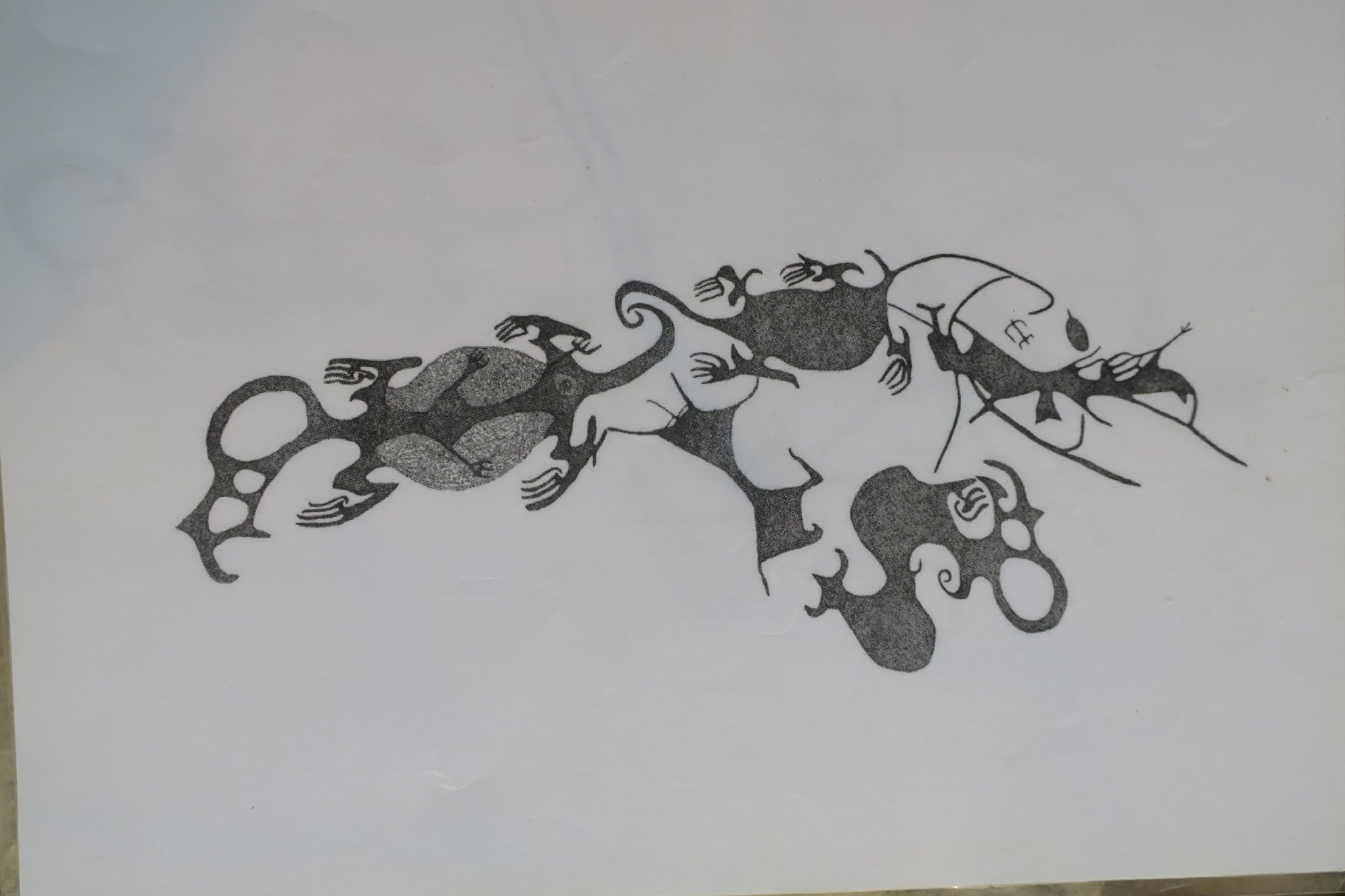
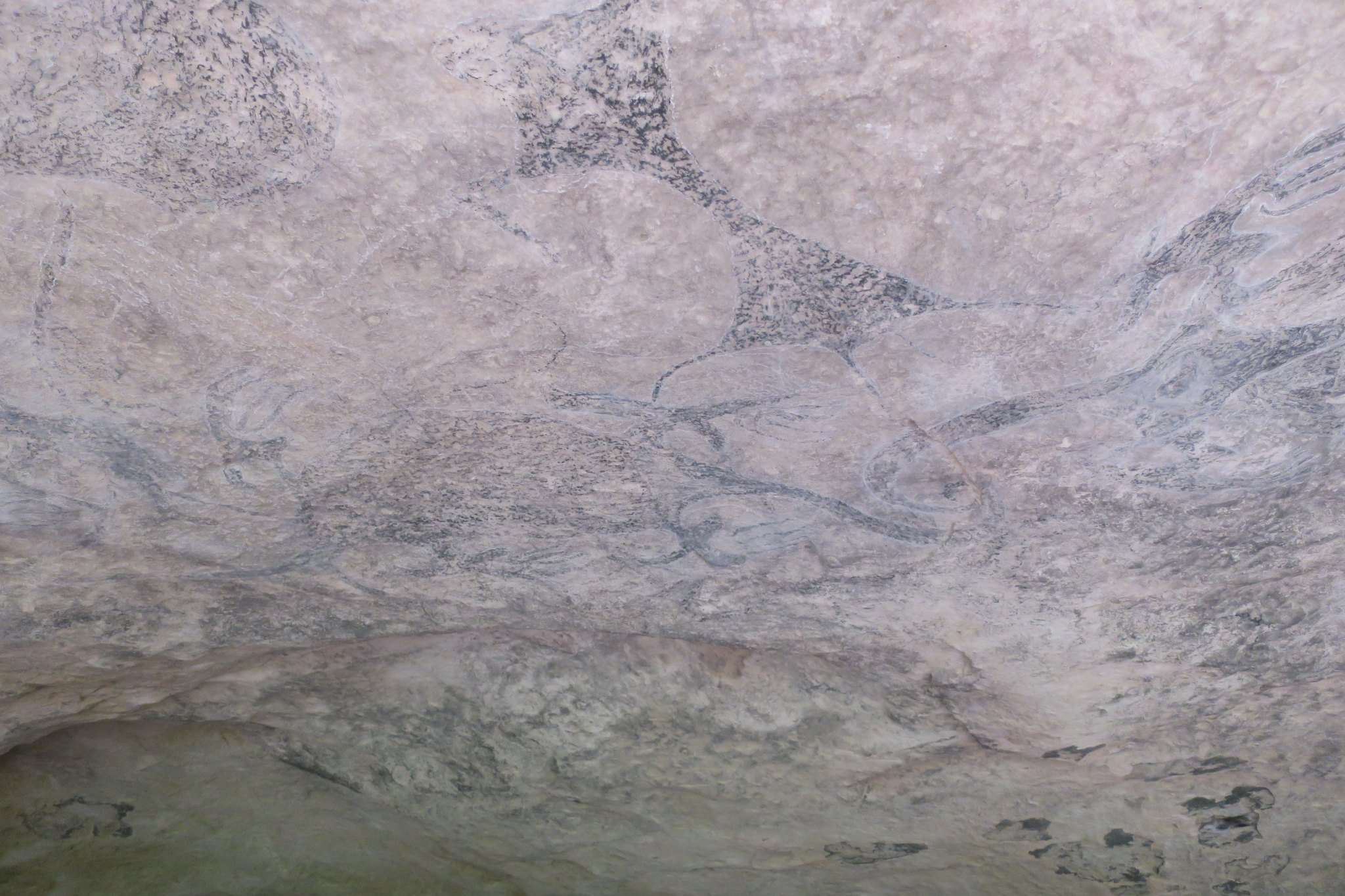
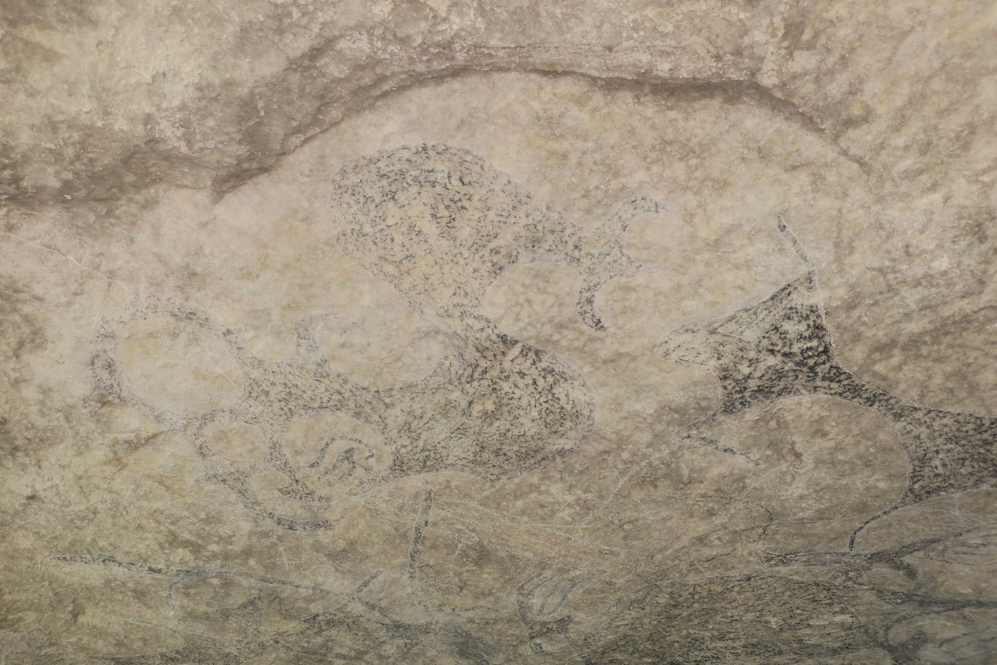
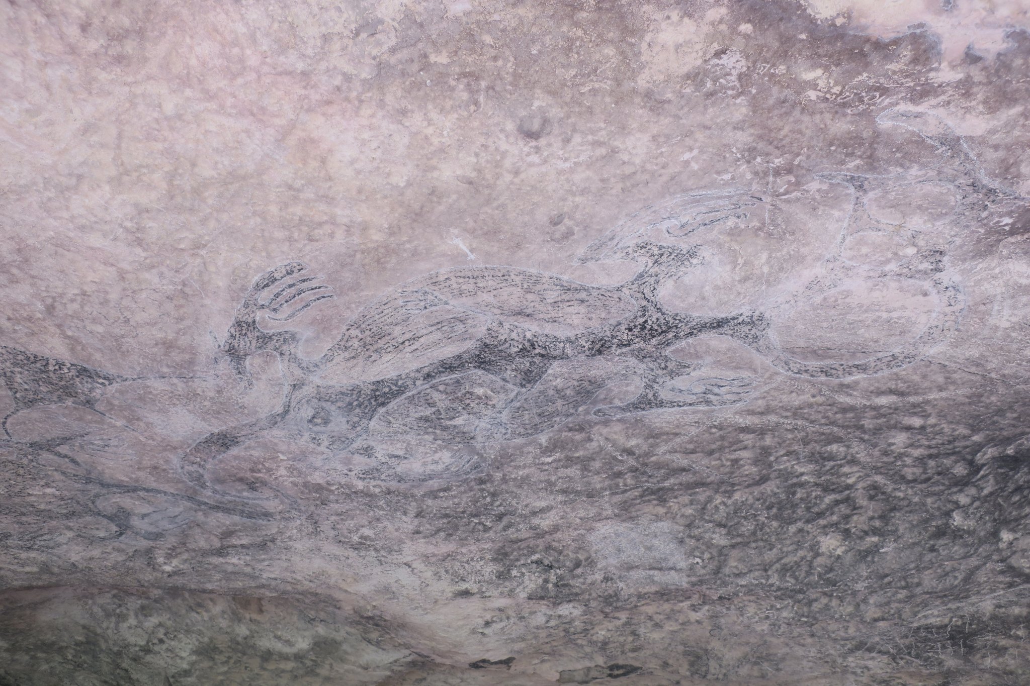
After talking to Wesley and looking around at the exhibits, we followed Wesley to the cave with the art. It was in a small valley that the Maori were trying to return to its natural state. They had planned 7,000 trees and planned to plant another 43,000 trees. It was an ambitious project. We walked to the cave which was fenced off. It was hard to see the art work as the pigment was very faint. Here are pictures of the cave and a graphic clearly showing the art.
Here’s a picture of Wesley.
We said good bye and good luck to Wesley and returned to the campground. Rick made dinner and I had my pie which was quite good.
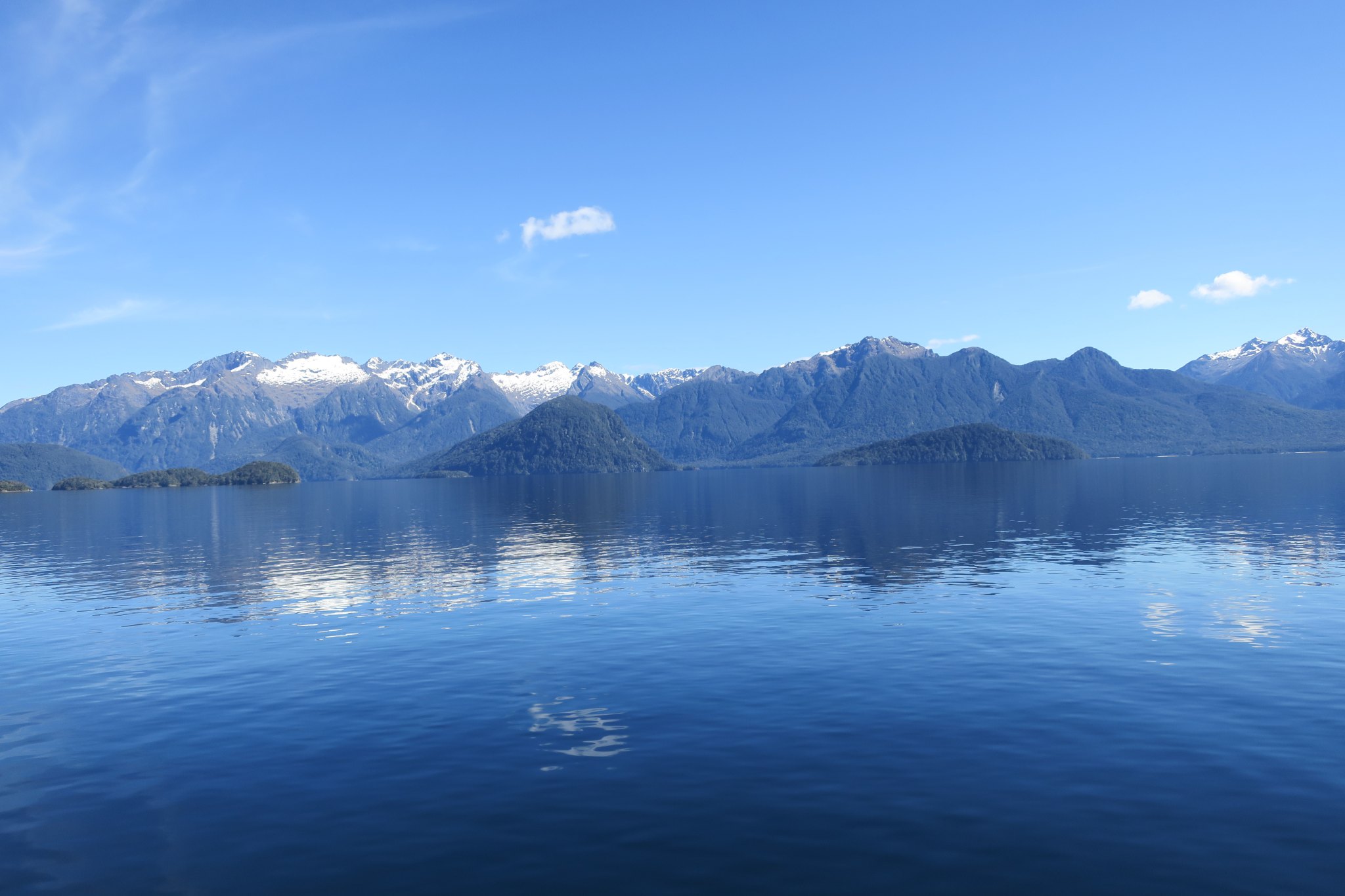
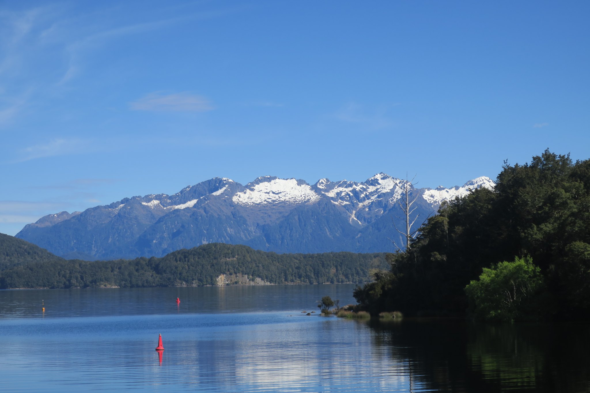
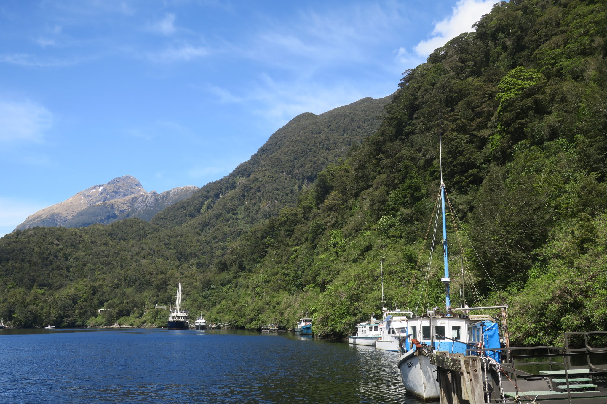
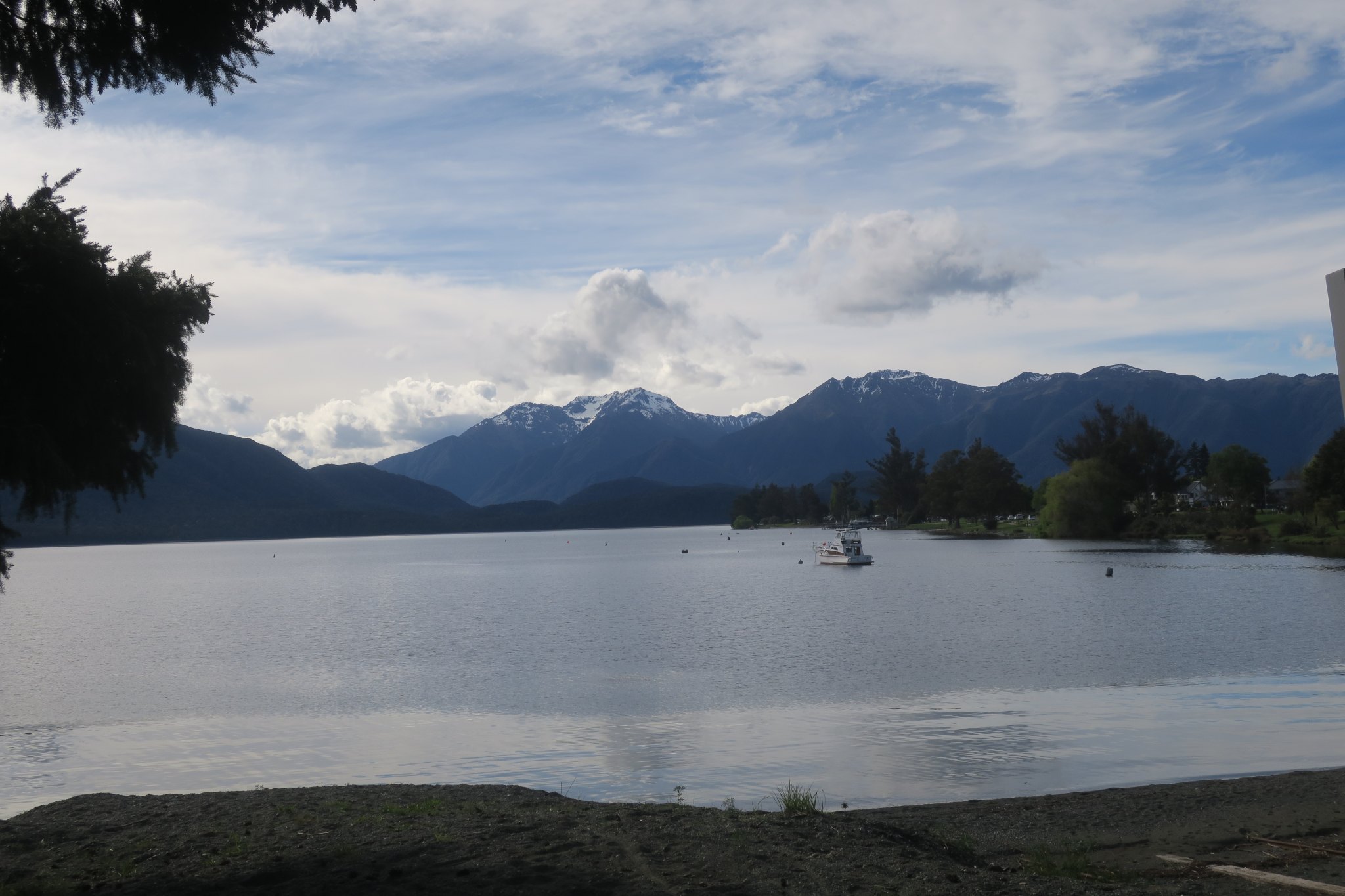
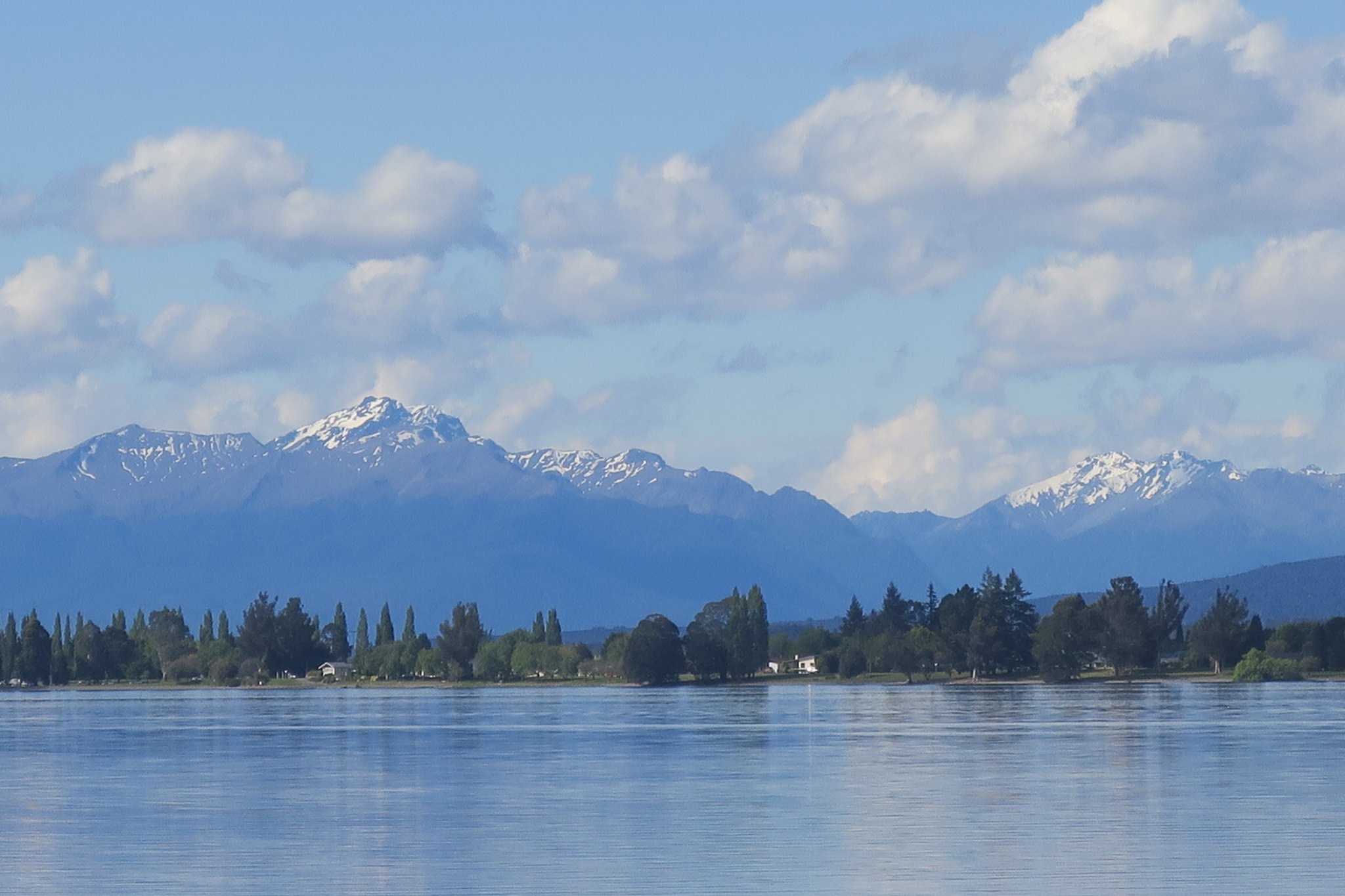
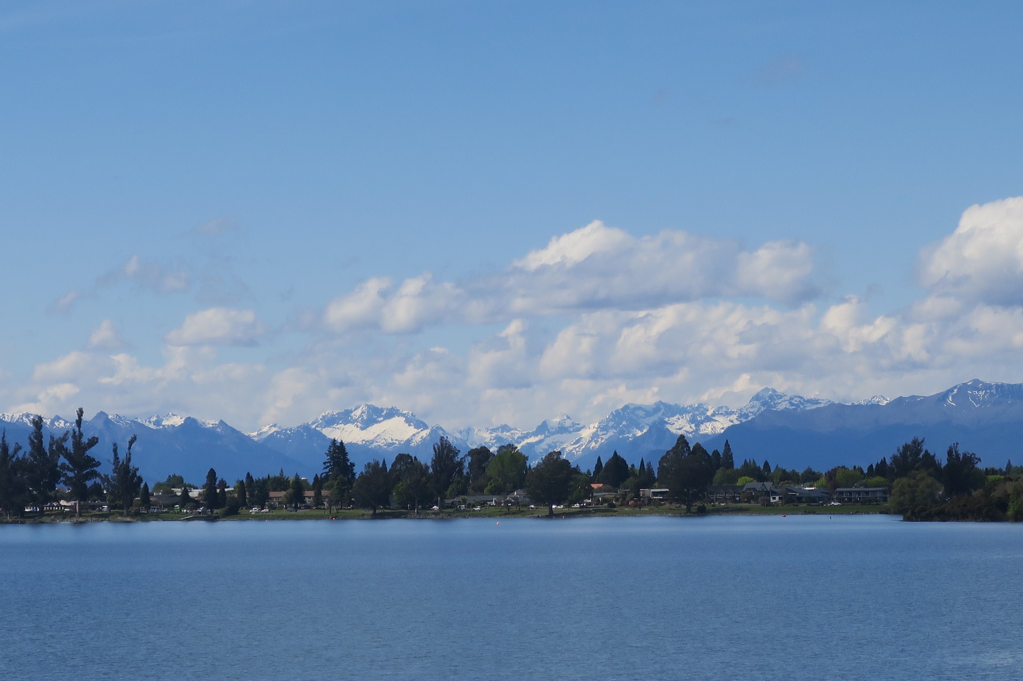
We were up early because we were on the 7:45 glowworm excursion. We started by taking a 20 minute boat ride across Lake Te Anua which we later learned was named after the daughter of a Maori chief. Here are pictures of the lake.
We arrived on the other side and were met our guide. He took us into the cave. We walked on walkways over raging water. The water was really loud and so clean we could drink it. I think caves are cool and this one did not disappoint. It was beautiful, but unfortunately we couldn’t take pictures. We started seeing glowworms as soon as we entered the cave. We walked along for awhile and then got into a small boat. It was completely dark except for the glowworms and our guide pulled us through the grotto on a line strung overhead. Our guide asked us to be silent and it was very cool to be in this dark, quiet space peering at the phosphorescent lights emitted by the glowworms.
Insects are sweep into the cave by the raging water that flows into and through the cave. Glowworms are about an inch long, look like slender slugs and have an organ on their tail which emits light. They create “fishing lines”, threads that hang down from the ceiling of the cave covered with a sticky substance. They use the light in their tail to attract insects. When one gets caught the glowworm reels it in and injects enzymes into the insect’s eyes to start the digestion process. No surprise what comes next… Yuck! After the worm has matured a bit it pupates and emerges into a moth-like creature to mate. They only live long enough to mate, males live for 76 hours and females live for 96 hours, just long enough to create the next generation.
After the cave we headed back to the visitor center for a short lecture on glowworms. Then back on the boat to Te Anua.
Here’s an interesting story that we heard on the way back across the lake that gives a little insight into the New Zealand psyche. Milford Sound is just a little north of Doubtful and very popular with tourists because it is close to Queenstown. Parking was a big problem and the government considered put up a three story parking garage. However people balked, saying this is about nature not commerce, we don’t want all these cars here. So they increased the price for parking to $10 per hour and improved the public transit system. New Zealand logic!
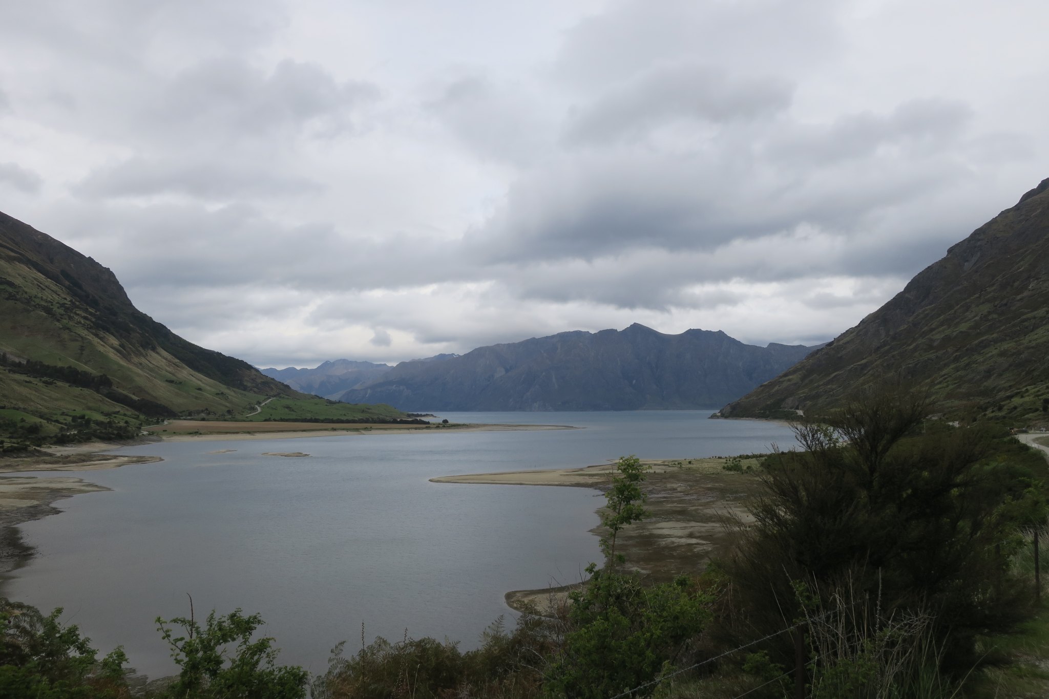
Once back on dry land we went to the grocery store and got some pastries for breakfast and got underway. We planned to drive to Dunedin. The drive was mostly across a plain surrounded by gently rolling hills, covered by sheep and cows. I know I keep saying this but it looked like Switzerland!
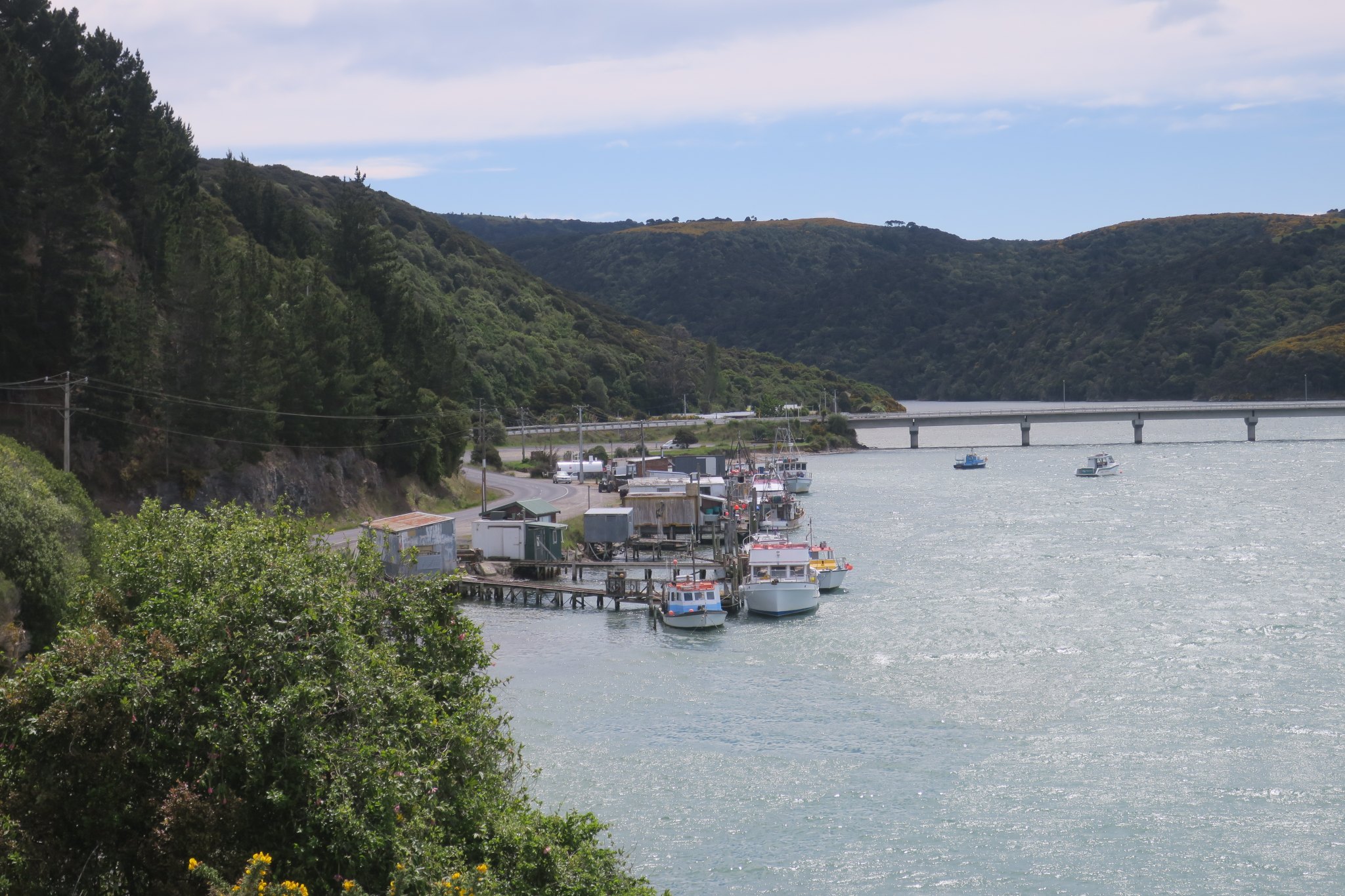
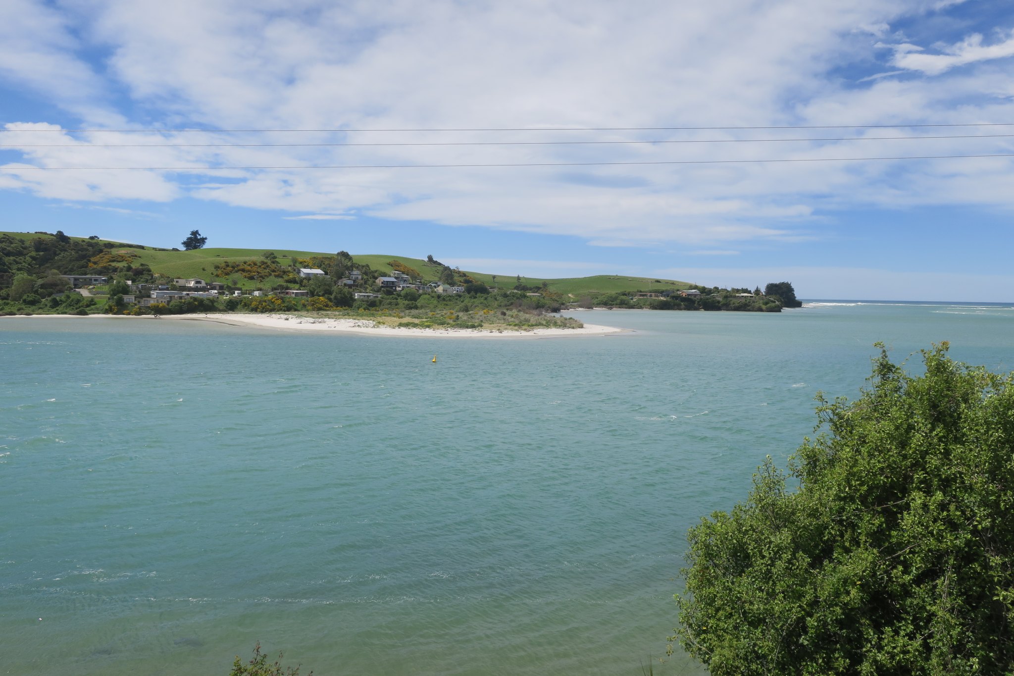
We stopped to take a picture and met up with Edward and Diane, our friends from Te Anua. Rick had started talking to them in the supermarket parking lot and later that day they appeared at the camp ground we are staying at. They are Dutch nationals currently living in Norway. He is a fishing guide and they own a campground near their home. They have spent a lot of time in New Zealand previously and told us about a nice campground on Otago peninsula. We followed them there, making a number of photo stops on the way.
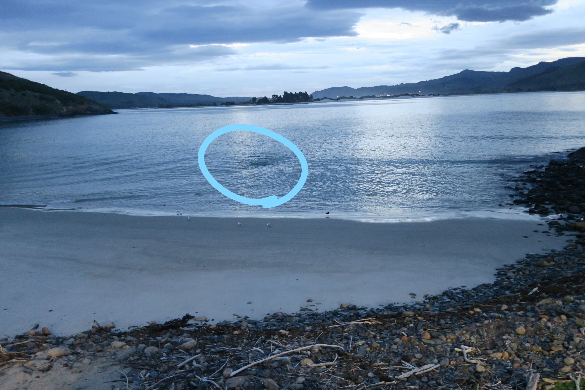
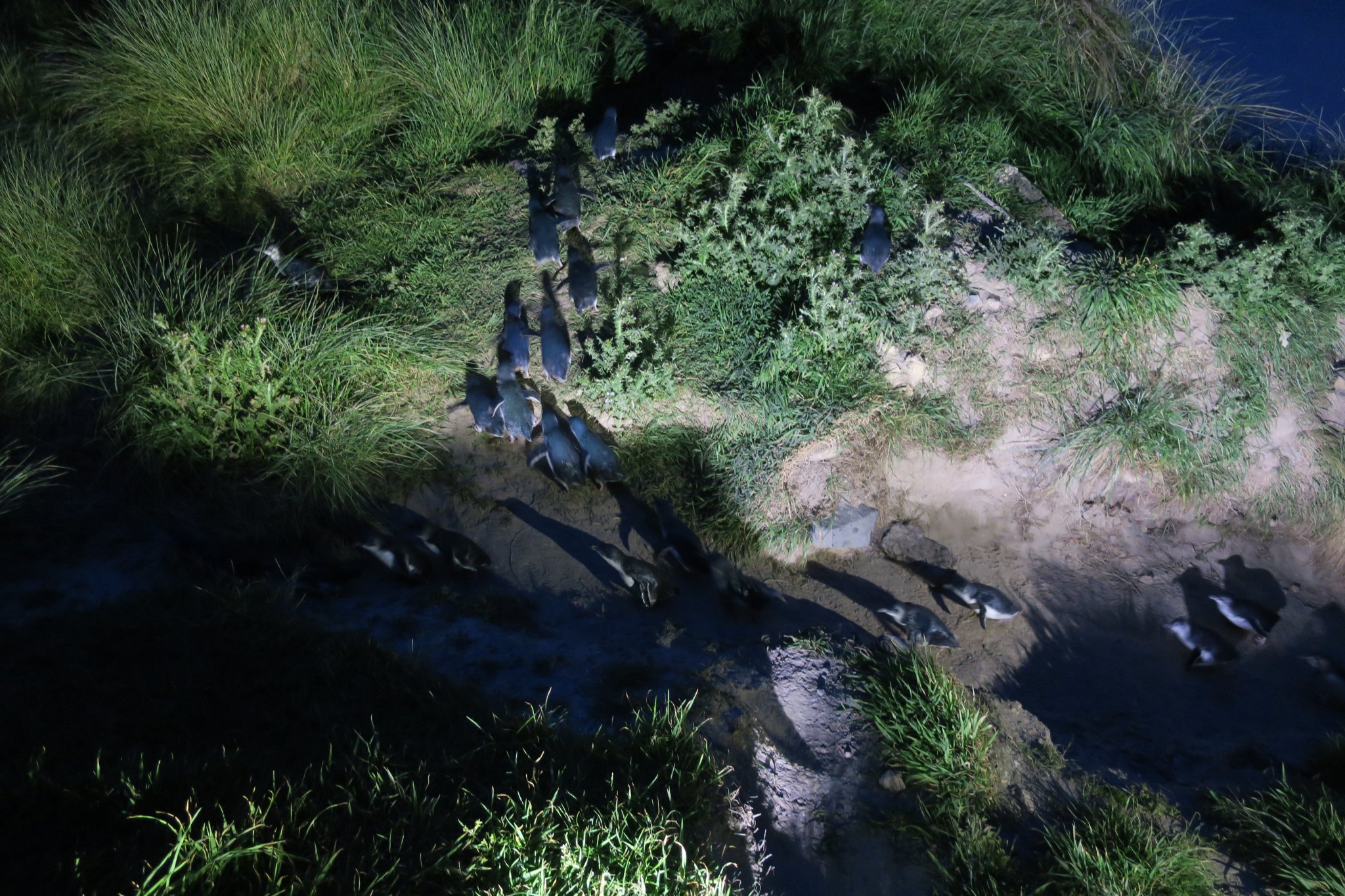
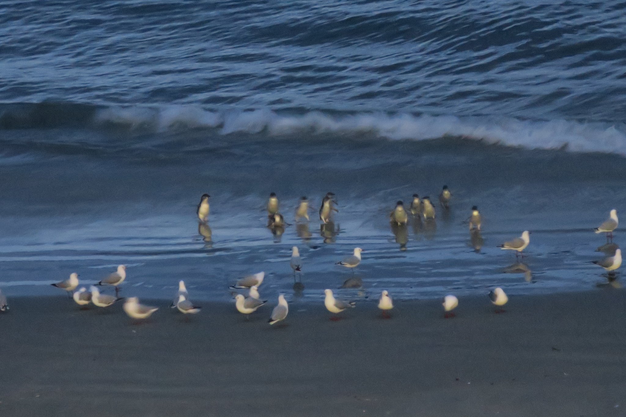
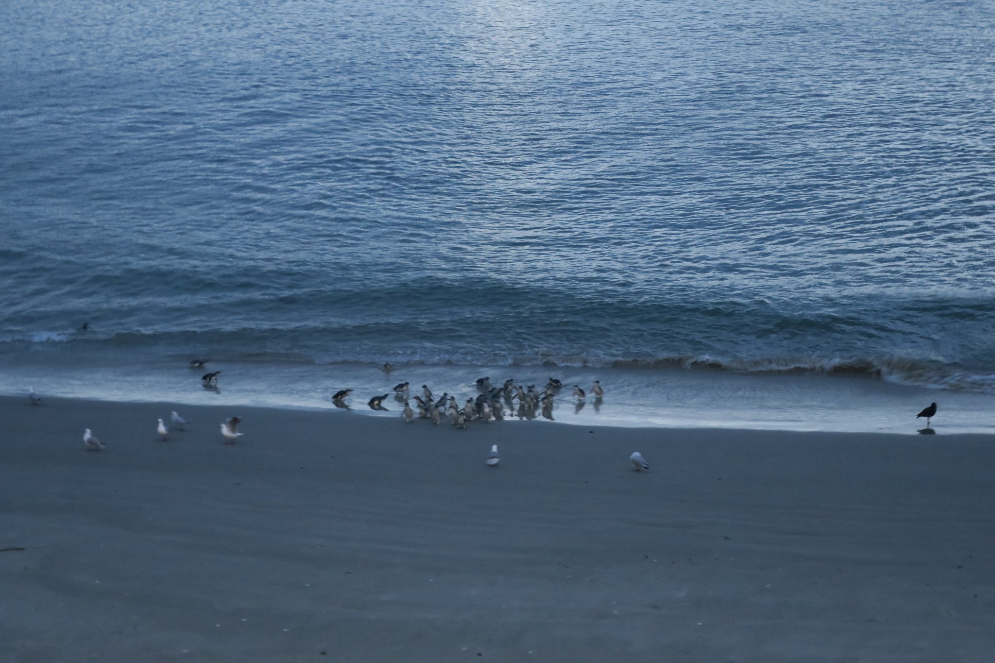
We arrived at the campground and Rick and Edward had a beer and talked for a while. Meanwhile, I was investigating things to do. We decided to see the blue penguins at the Royal Albatross Center. After dinner we headed northeast about 10 miles to see the penguins. Blue penguins are the smallest penguins in the world, weighing about 2 pounds. They go to sea all day to feed and return to their nests as it is getting dark. There is a colony of them next to the Royal Albatross Center. At 8:30 our group headed down to a viewing platform next to the beach. The penguins assemble in the water and come ashore in large groups called rafts. We saw a total of 155 penguins which came ashore in 6 groups. They climbed the penguin highway and headed back to their nests. We didn’t get great pictures because it was dark and we couldn’t use a flash but they were very cute and fun to watch.
I circled a raft of penguins
The staff warned us that as we drove away to be careful of penguins that had wandered to the road. We were driving cautiously and sure enough three penguins wandered in front of us. We stopped and two of them walked back to the edge of the road. The third one stayed under the van, a little shocked and very afraid about joining his buddies. There were probably a dozen cars behind us all stopped waiting for this penguin to get out from under the van. Finally he decided to move on and we continue back to the campground without another penguin sighting.
Today we are going to Doubtful Sound. It was a beautiful day and the rain that was predicted did not materialize. We were picked up by a bus at the campground which took us to Lake Manapouri, about a 20 minute ride.
We have seen signs about banning 1080 and didn’t know what that meant. A lady on the bus and the bus driver explained it. The only mammals indigenous to New Zealand are bats, all the other mammals were introduced by humans throughout the islands 800 year recorded history. Today they have issues with over population of many of the mammals humans introduced; rabbits, weasels, rats, deer, just to name a few. The government is trying to manage the situation by dropping a poison called 1080. Many people want the government to stop using it because it indiscriminately kills everything that touches it. There’s also concern it will poison the water supply.
Here’s the story of one mammal that was brought to New Zealand. Deer were brought to here in the late 19th century for sport. They spread rapidly as they had no predators and plenty of food. Starting in 1920 the government employed cullers to shoot the deer because they were damaging pastures, young exotic trees in plantations and native forests. Eventually the farmers realized they could capture the deer and raise them for vension (I think most of the vension is exported to China). So then they started hunting from helicopters. When a deer was spotted they would jump out, wrestle them to the ground and then transport them to a farm. There are obvious problems with that methodology so they developed a dart that they shot at the dee. The dart contained a net that entangles the deer and provides the means to capture and transport them to the farms. Today the farmers have enough deer to sustain their herds so the deer population is once again exploding.
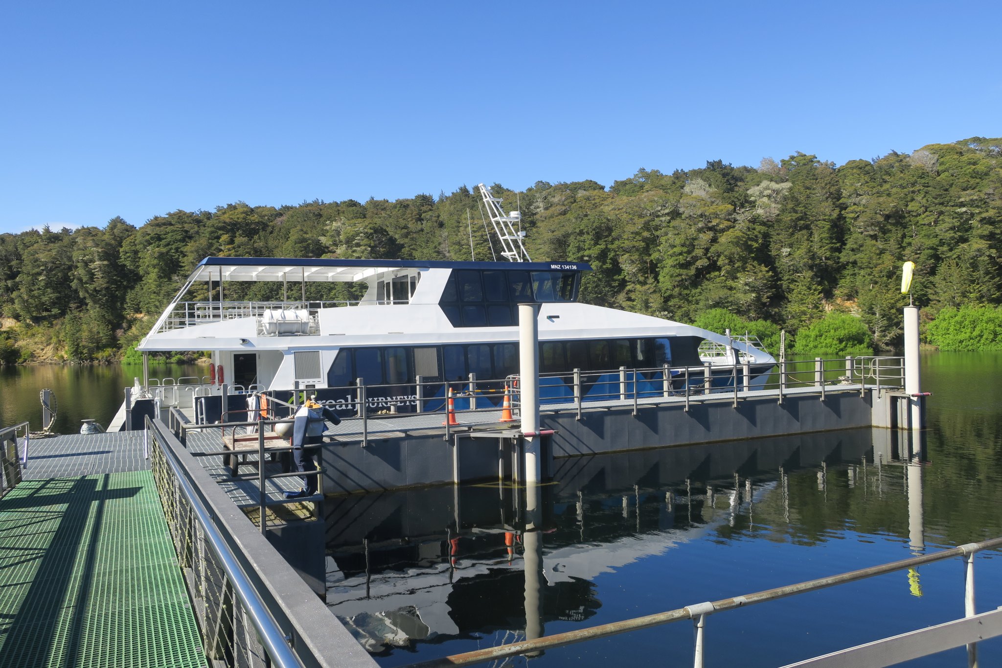
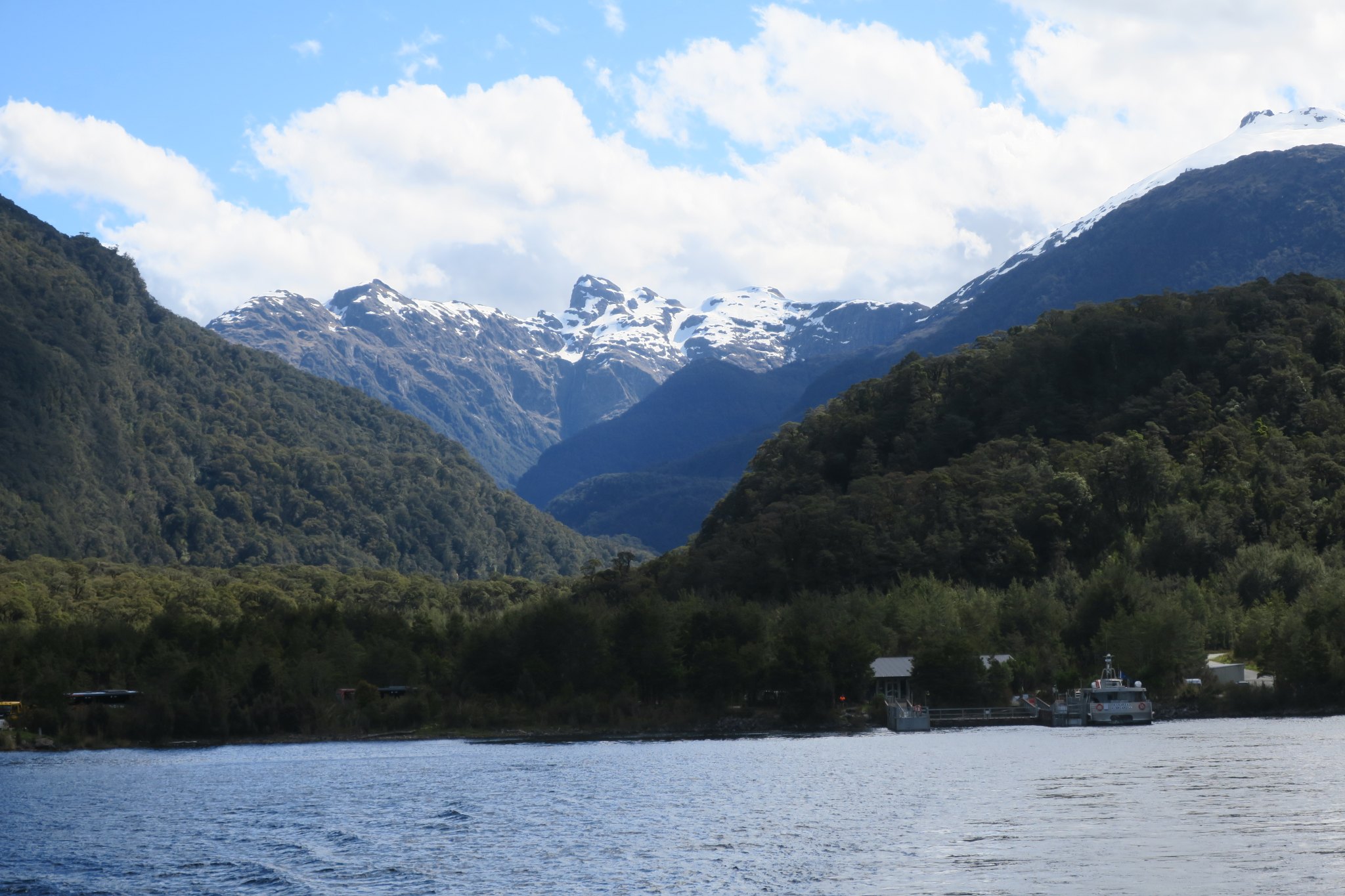
Back to our day, we got on a boat which took us across Lake Manapouri. Here are pictures from Lake Manapouri.
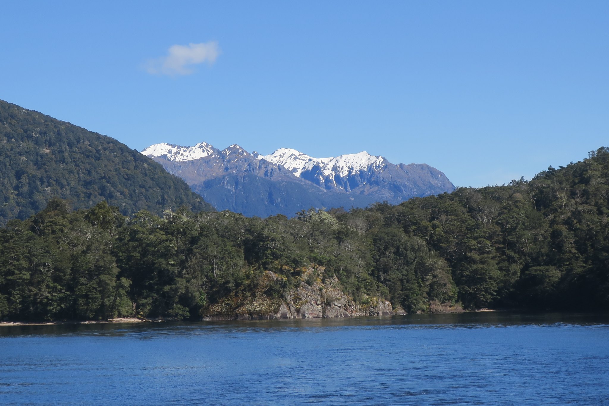
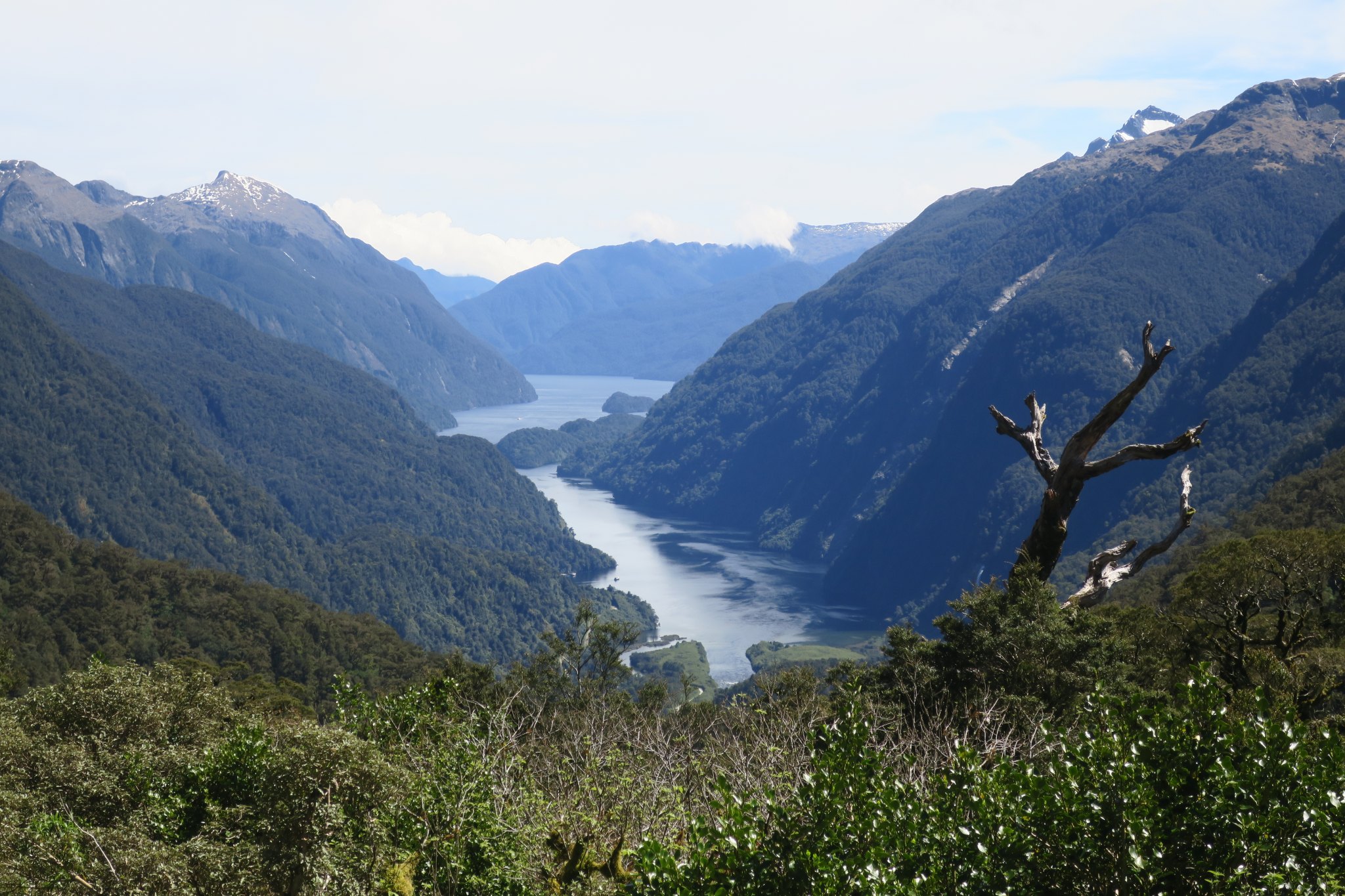
Next step, onto a bus which traveled through the Fiordland National Park to Doubtful Sound. The only way to access the road we traveled on was by boat. It was built in the 1960’s to transport equipment to the edge of Lake Manapouri where they were built a hydro power station. Here are some pictures from a scenic stop on our bus ride.
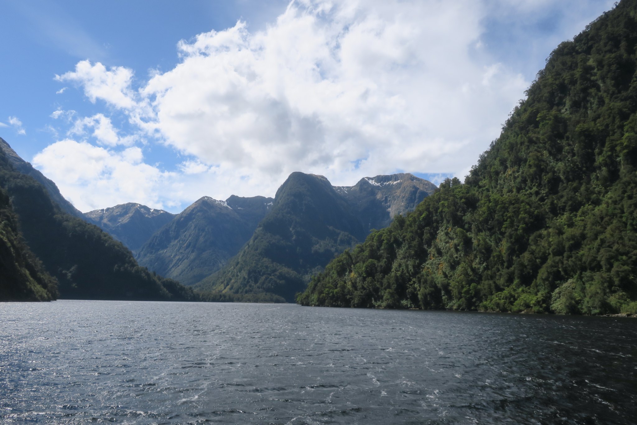
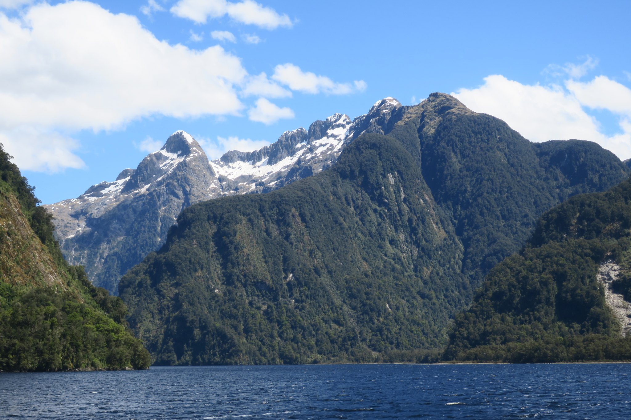
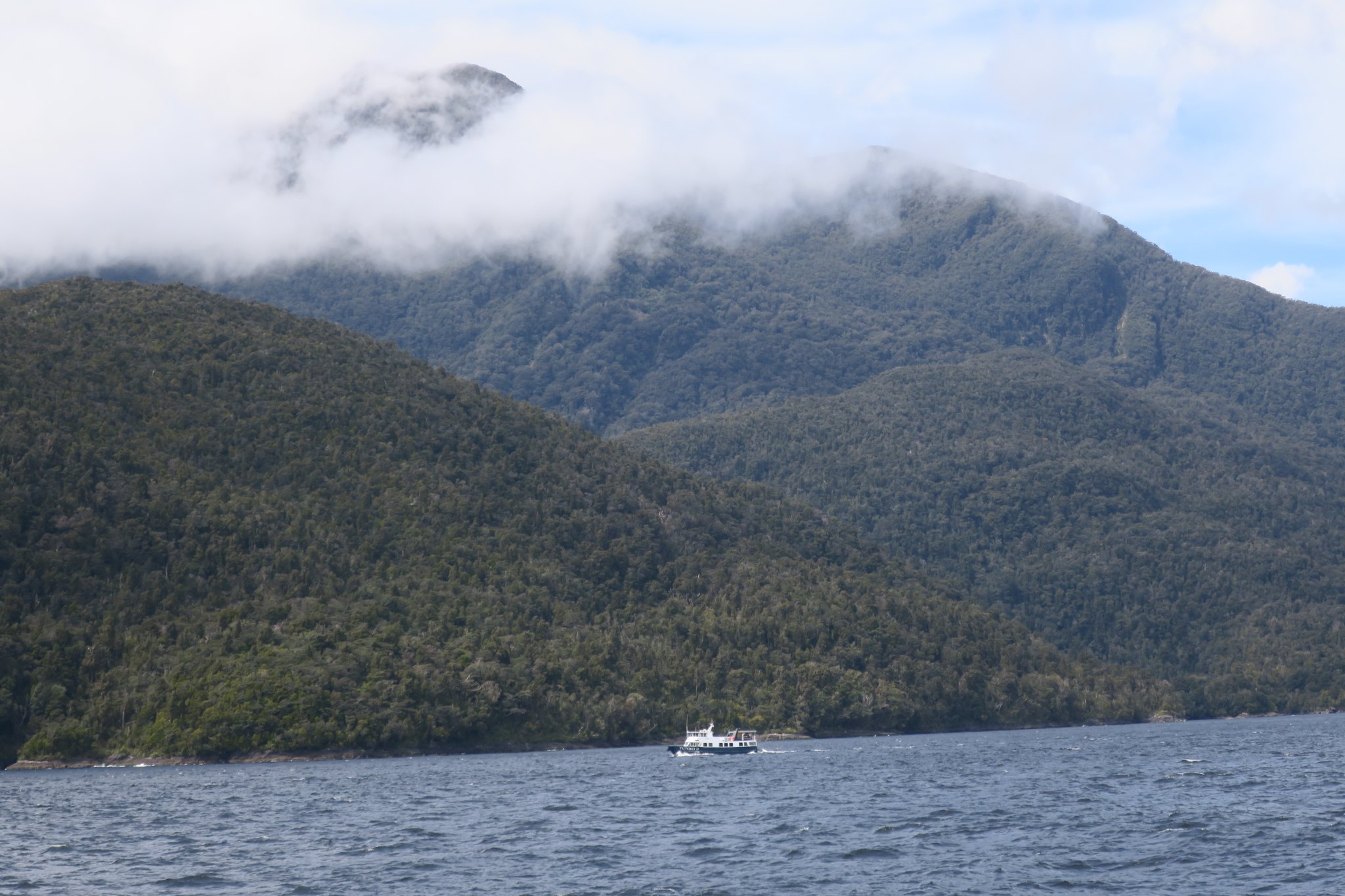
Once we reached Doubtful Sound we got onto another boat which took us out into Doubtful Sound. We checked out some of the “fingers” along the way. The trip out to the end of the sound, where it meets the Tasman Sea, took about an hour and a half. We had ordered box lunches which we enjoyed en route.
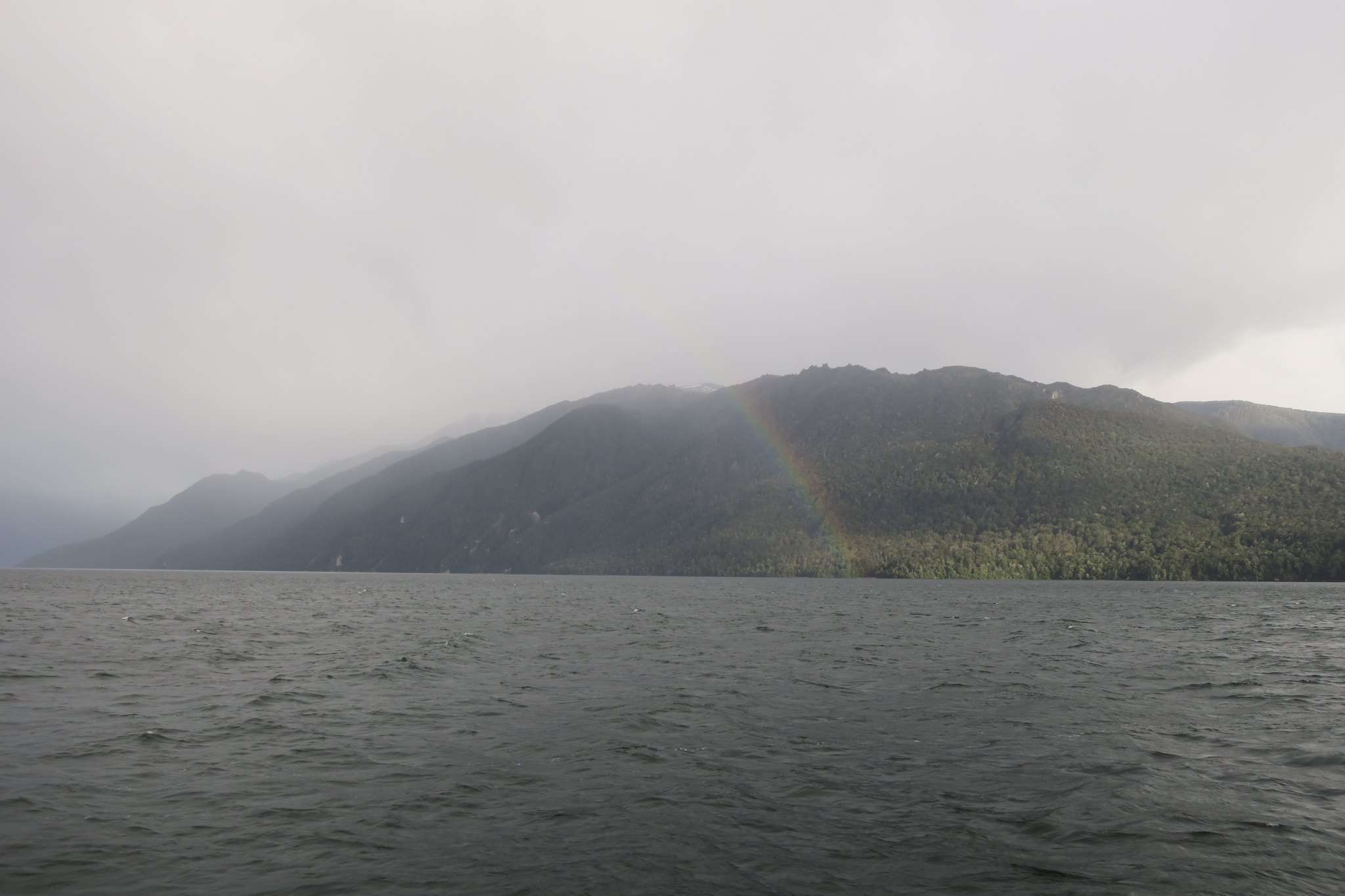
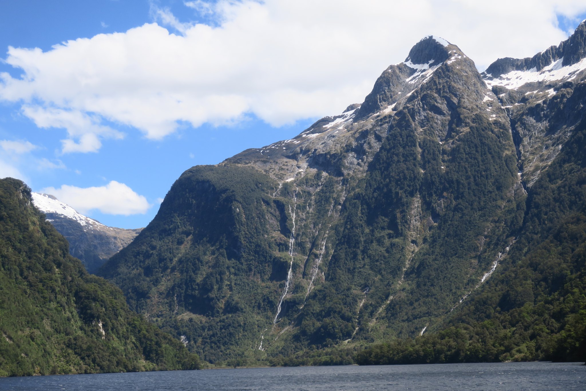
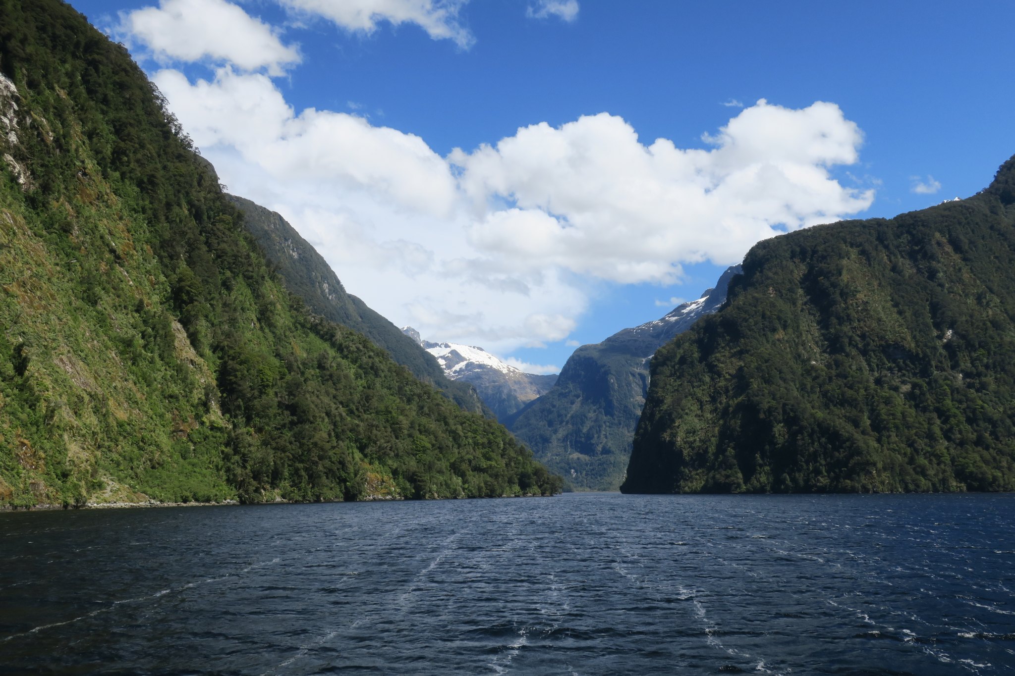
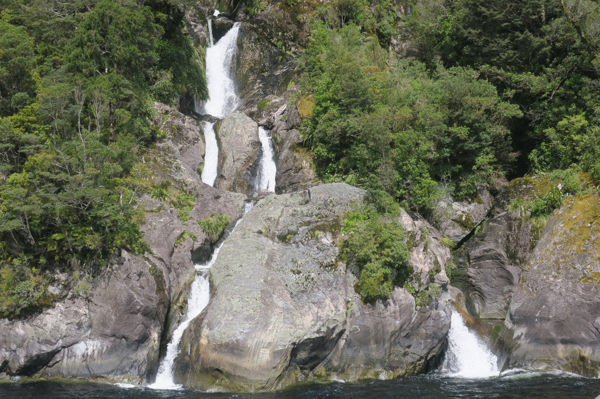
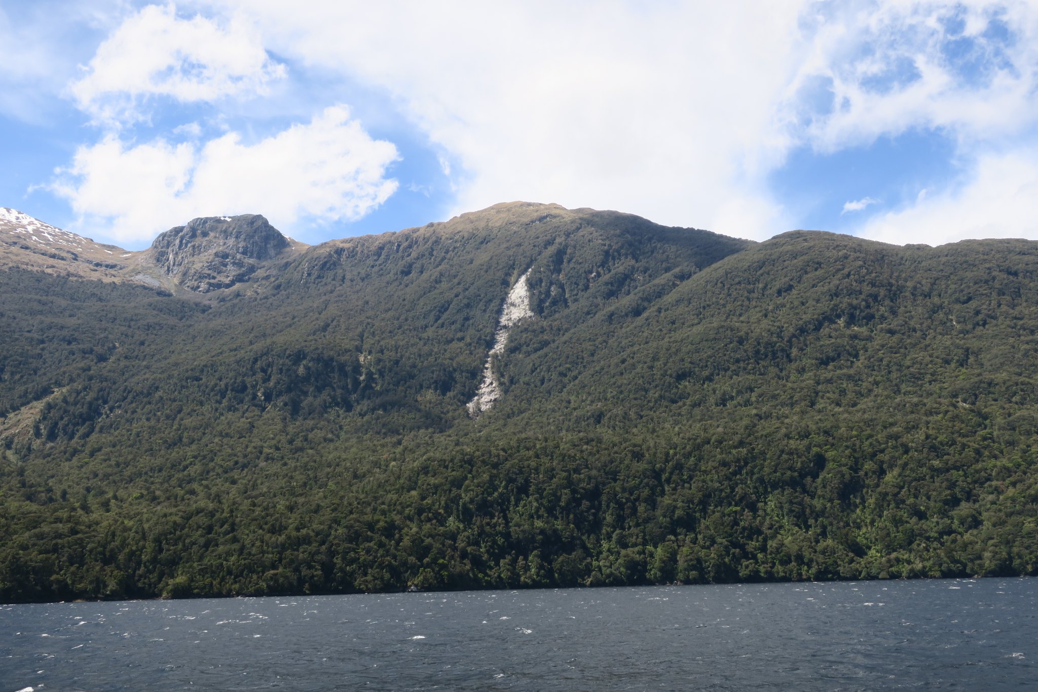
We saw quite a few waterfalls both from the bus and from the boat. If it had been raining, which it does on two out of every three days, we would have seen more, but we were thankful for the glorious weather. The weather was great for most of the day but as neared the Tasman Sea it became cloudy, foggy and it started raining. Fortunately the bad weather didn’t enter the sound and our return trip was sunny and warmer. Here are pictures from our Doubtful Sound boat trip.
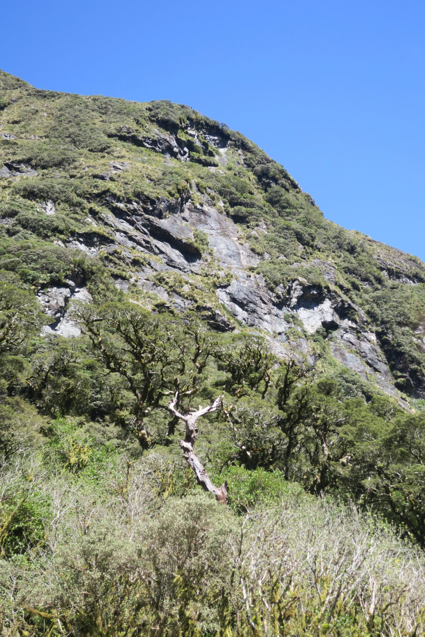
While en route a guide described the area. The reason Doubtful Sound is named as such is that when Captain James Cook came to the mouth of fjord he observed that the wind was always blowing west. He knew he could sail into the sound but was DOUBTFUL that he could sail out. Therefore he never went into the sound and wrote the word Doubtful on a the chart he created. In this area they have tree avalanches. What’s a tree avalanche? In much of Fiordland, as the area is called, the forest clings to steep faces of hard rock covered only by a think layer of rich, peaty humus and moss. The roots of the trees anchor into the roots of other trees so there is a huge network of roots holding the trees onto the rocks. Occasionally the trees grow too tall and the fragile root system can no longer sustain their weight. Once one tree goes it rips through the root network and a number of trees are ripped from the landscape, ie., a tree avalanche.
The rocky area in the middle of this picture is the result of a tree avalanche.
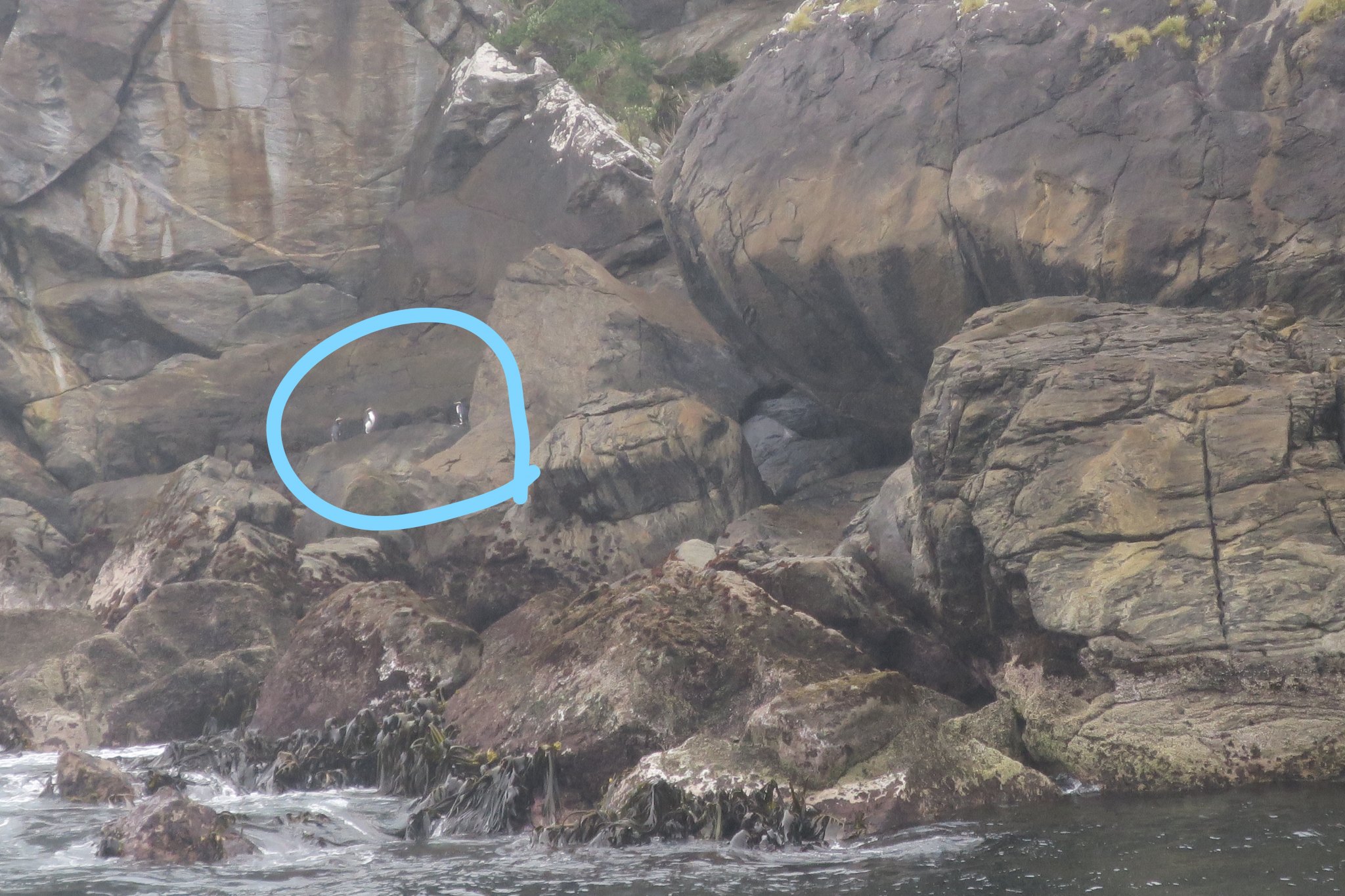
We saw fiordland crested penguins, but only at a distance. They were on rocks on an island just on the outer edge of the fiord. Their population is declining due to various predators, dogs, cats, rats and weasels, all mammals introduced by man. They are also vulnerable to human disturbance, fleeing nests and leaving chicks exposed to predators.
On another nearby island New Zealand fur seals were lounging on the rocks. We learned that female seals get pregnant 8 days after giving birth to the last seal, so basically they are perpetually pregnant!
It rains all the time in Doubtful Sound, in fact they get over 26 ft of rain in an average year. The rain travels down the hill, picking up tannins on the way and turning the water brown. The water is less dense than the salt water so it sits on top and filters out the sunlight. Therefore many deep water species grow in comparatively shallow water.
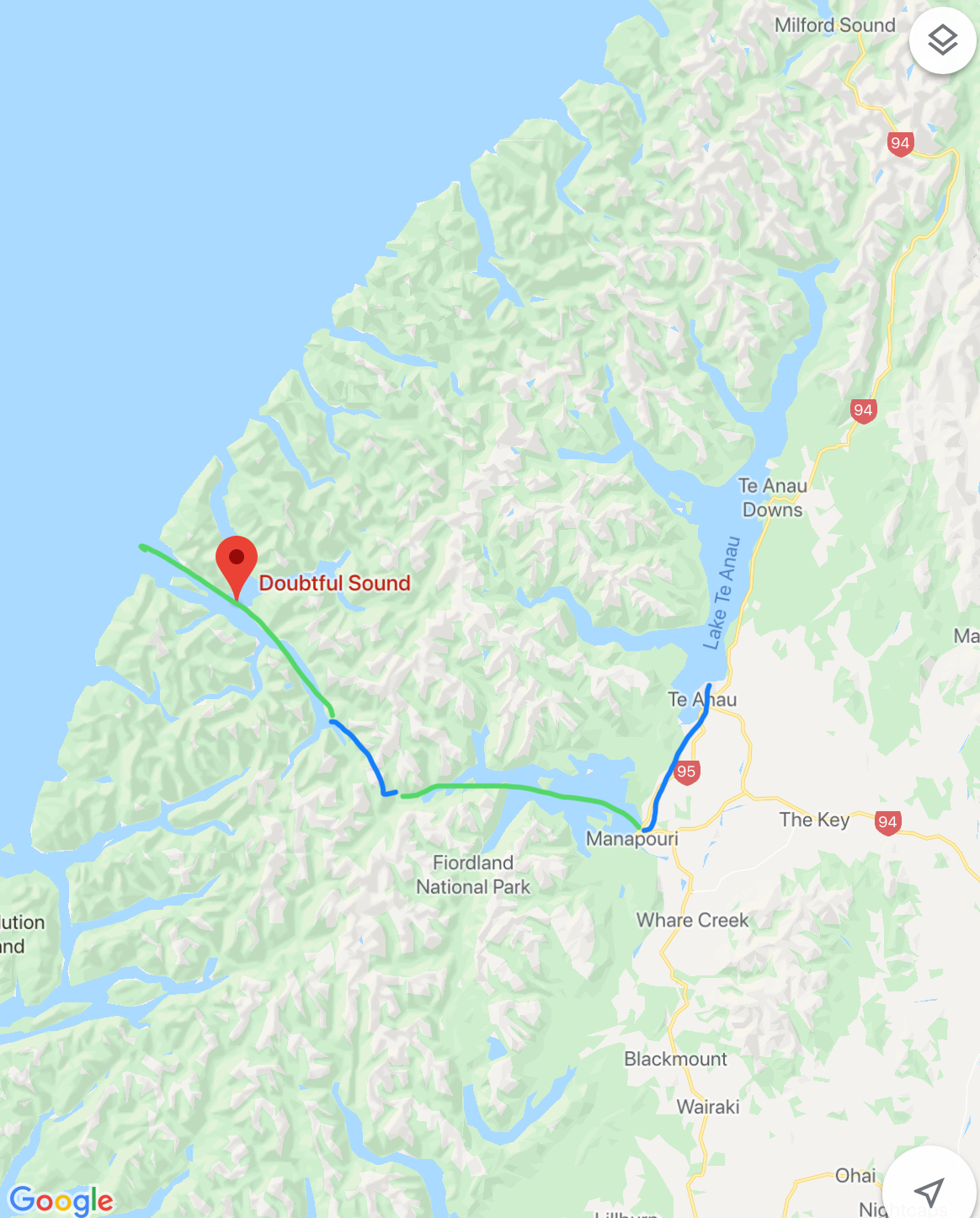
At the end of our Doubtful Sound trip we returned to Te Anua the same way we came. In the course of the day we took four bus rides and three boat rides. Wow! The trip to Doubtful Sound was definitely a highlight of our New Zealand trip. Here is a map of our travels today, Blue is by bus and green is by boat.
We were dropped off that the booking center and booked a trip for tomorrow morning to see the glowworms that live in a near by cave. Of course on the way back to the campground we had to stop by the grocery store.
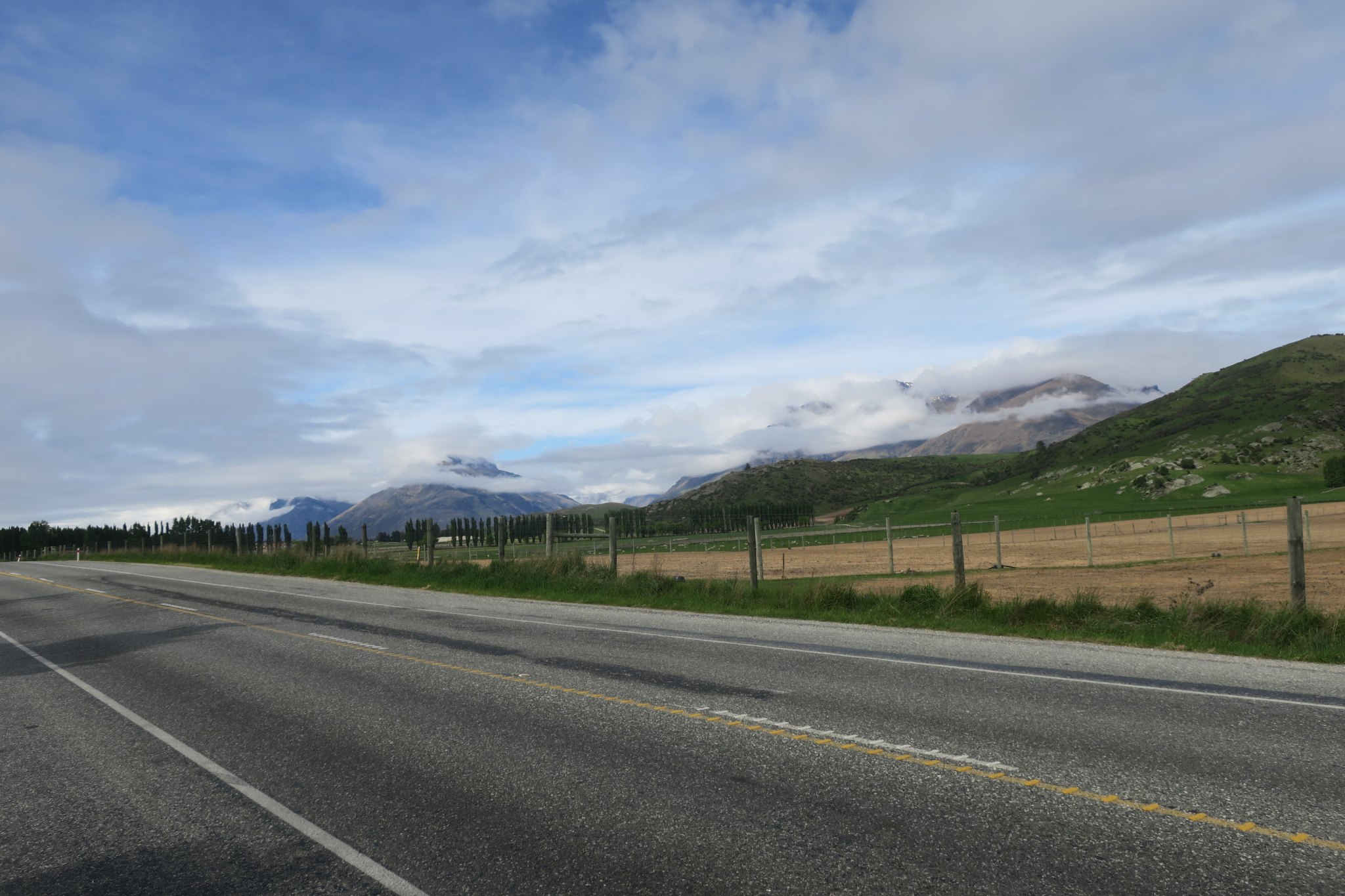
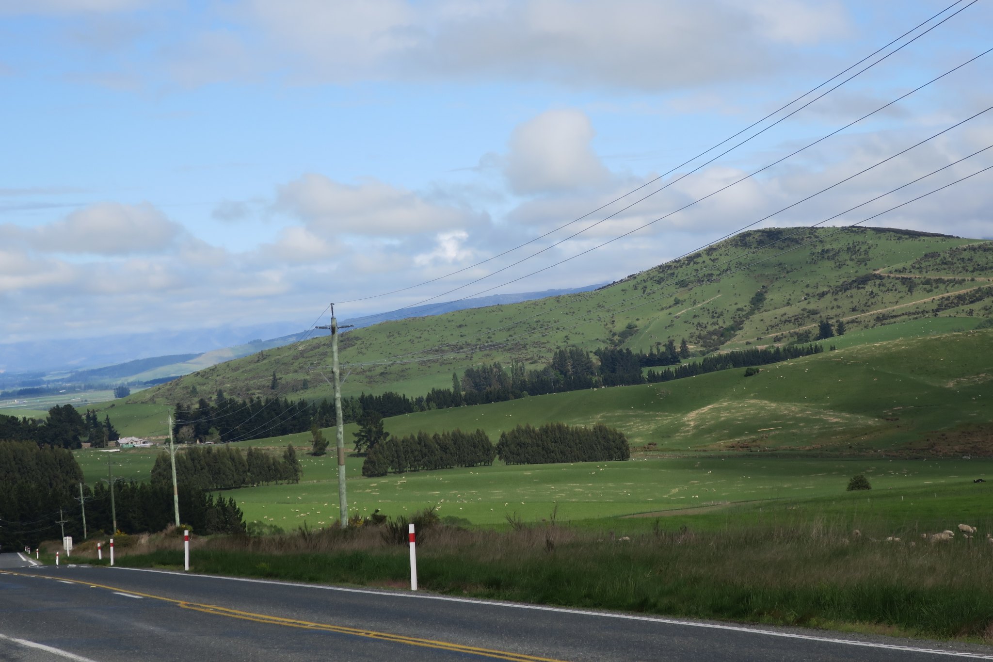
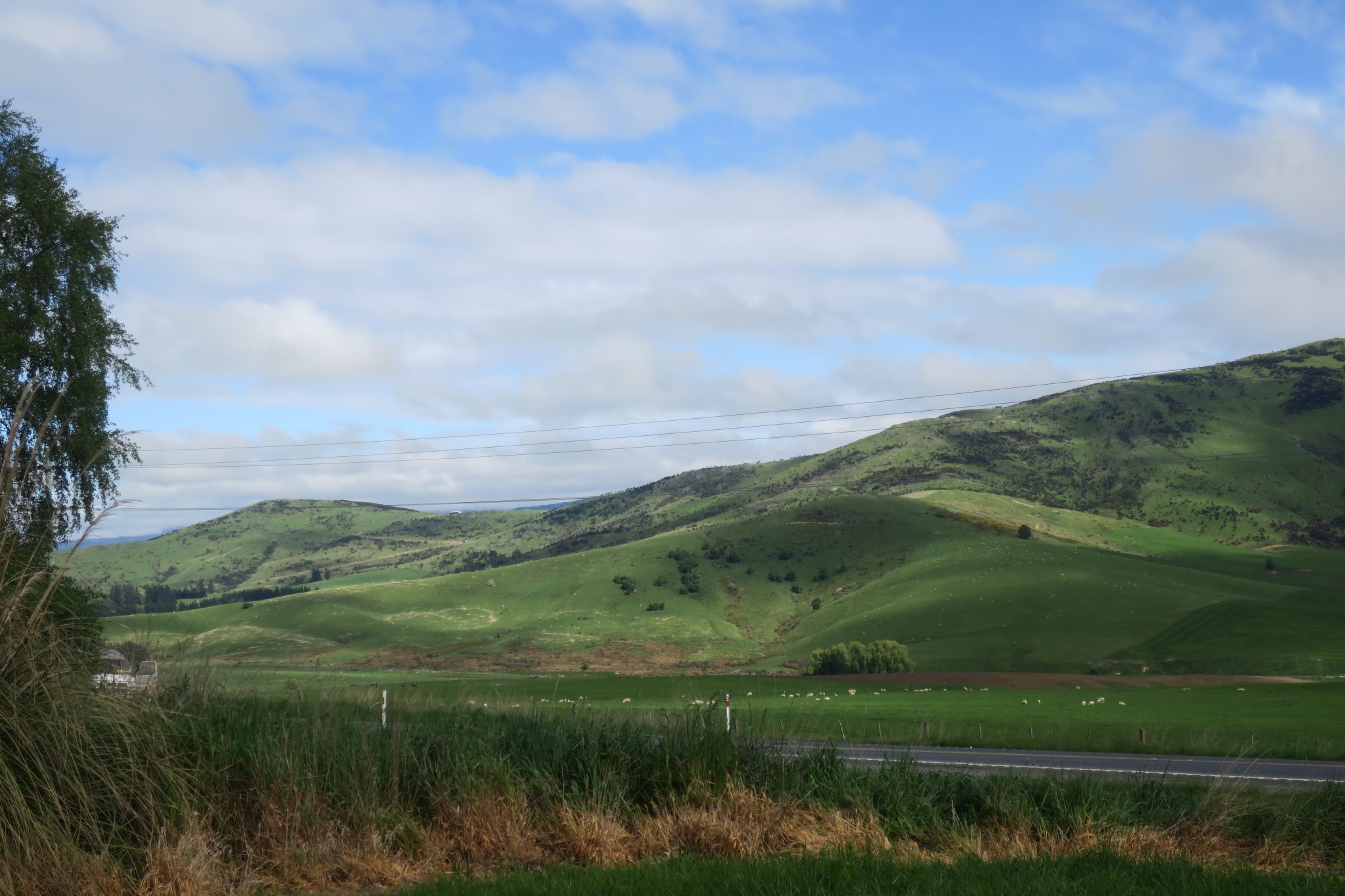
We went out for breakfast this morning and decided that rather than explore Queenstown we would go to Te Anua. It was a relatively short drive, just over 2 hours. There were lots of sheep, lamps, and cows along our route.
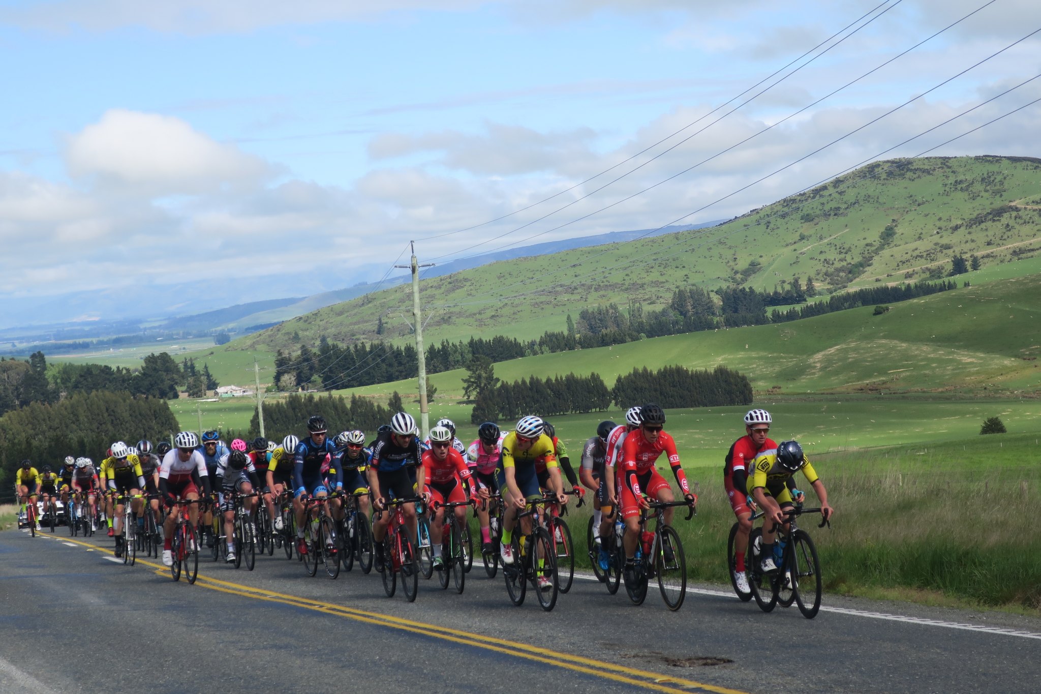
We stopped in one rest area to take a picture and shortly thereafter they closed the road for a bike race.
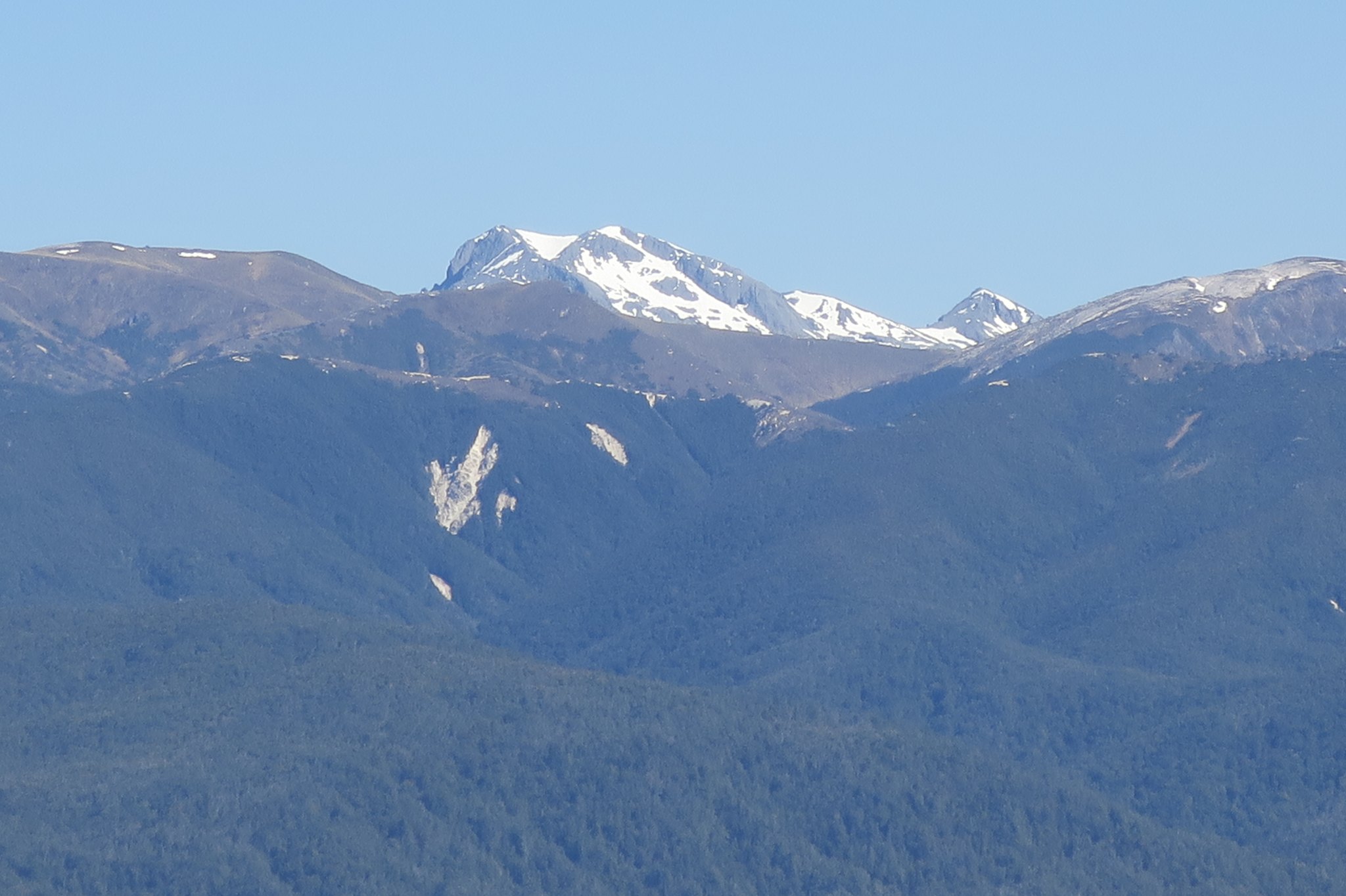
Most of the way we could see snow capped mountains. It looks like Switzerland (I know I keep saying that).
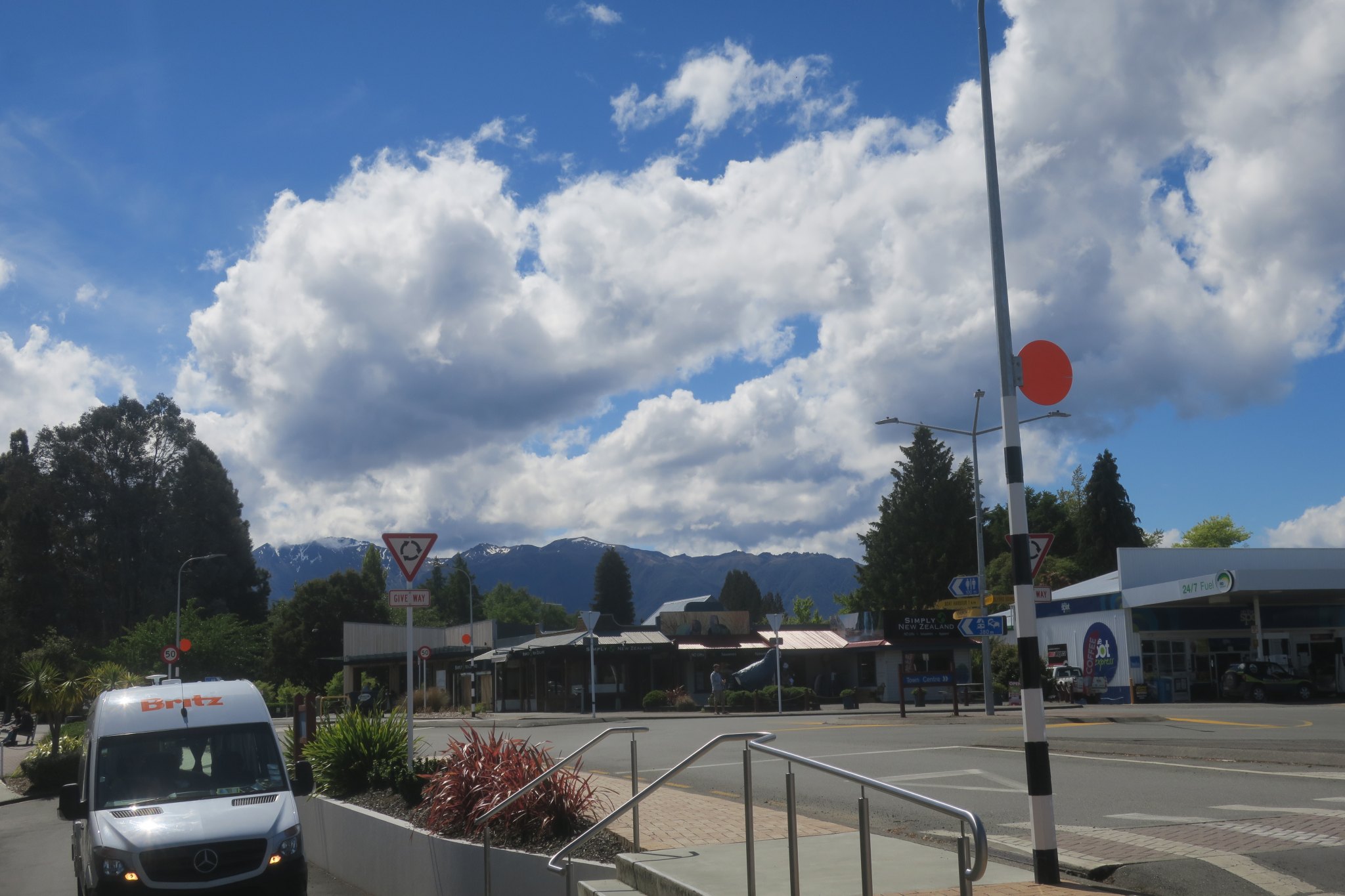
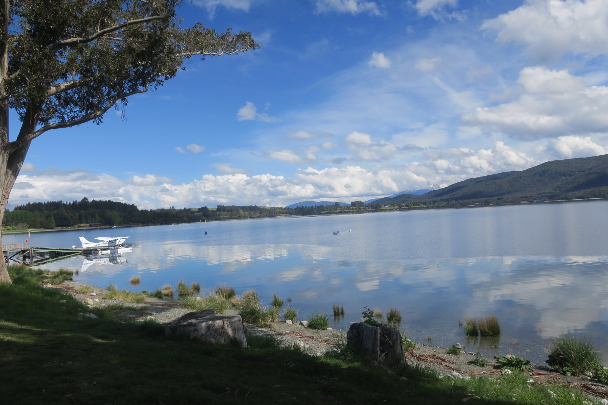
We arrived in Te Anau and did a little grocery shopping. The town’s backdrop are snow covered mountains.
After we stocked up we went to the campground, got settled and had some lunch. Then we went for a walk along the lake. It was beautiful. We walked most of the way with a couple from Canada and talked about travel adventures. Here are some pictures.
We didn’t get back to the campground until about 6:30. Rick worked on dinner while I researched the next phase of our trip. We have two choices—go to Mount Cook, the highest mountain in New Zealand, or drive along the coast. We are watching the weather closely because if it is raining or overcast we probably wouldn’t be able to see Mount Cook. We had chicken parmesan for dinner.
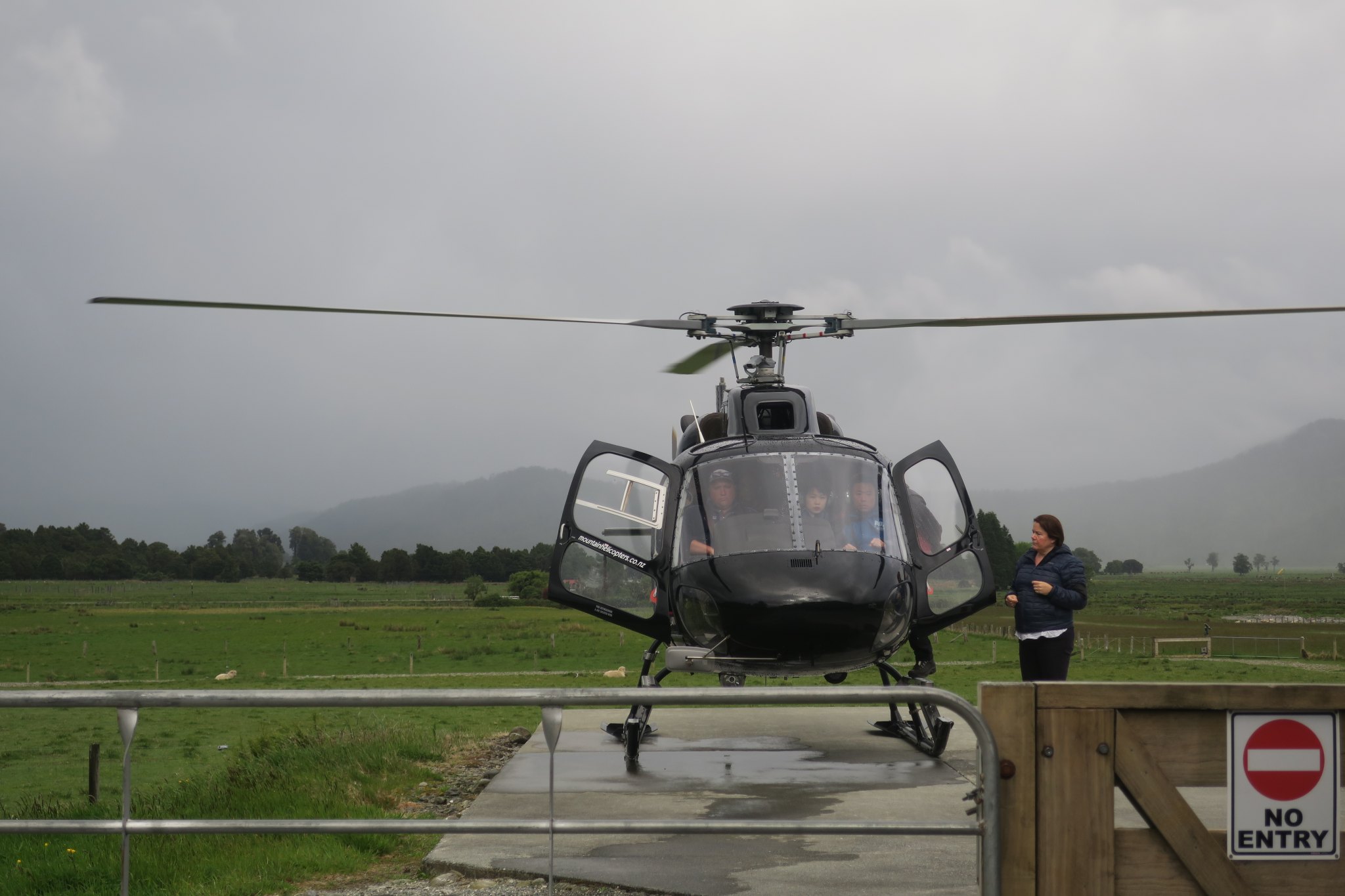
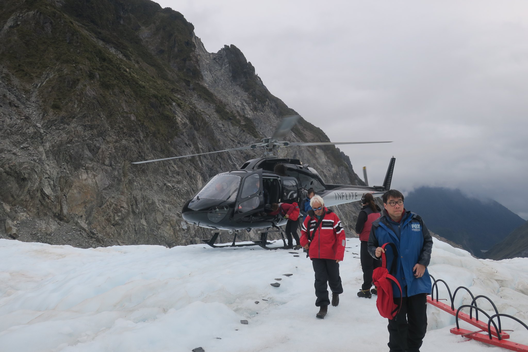
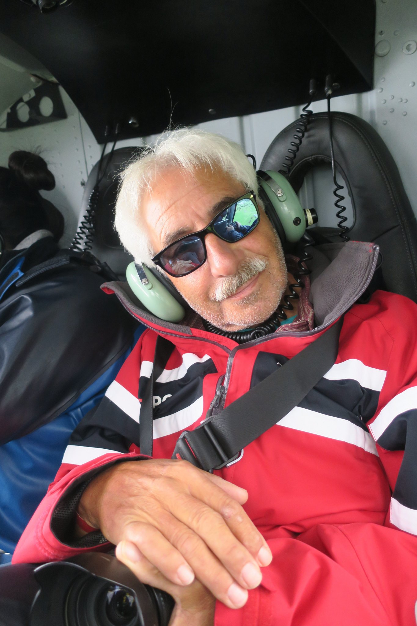
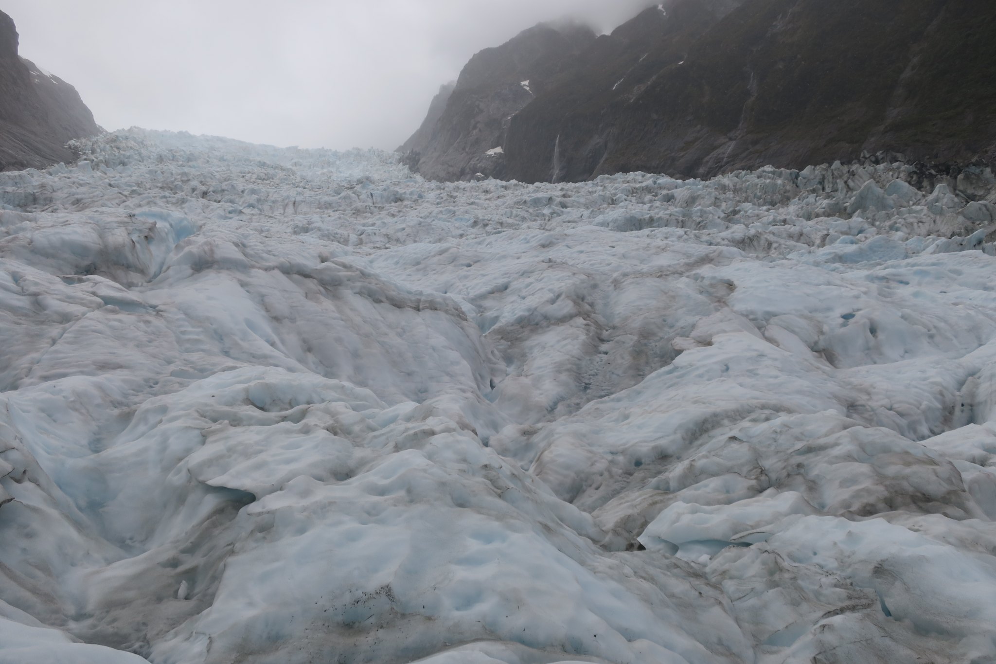
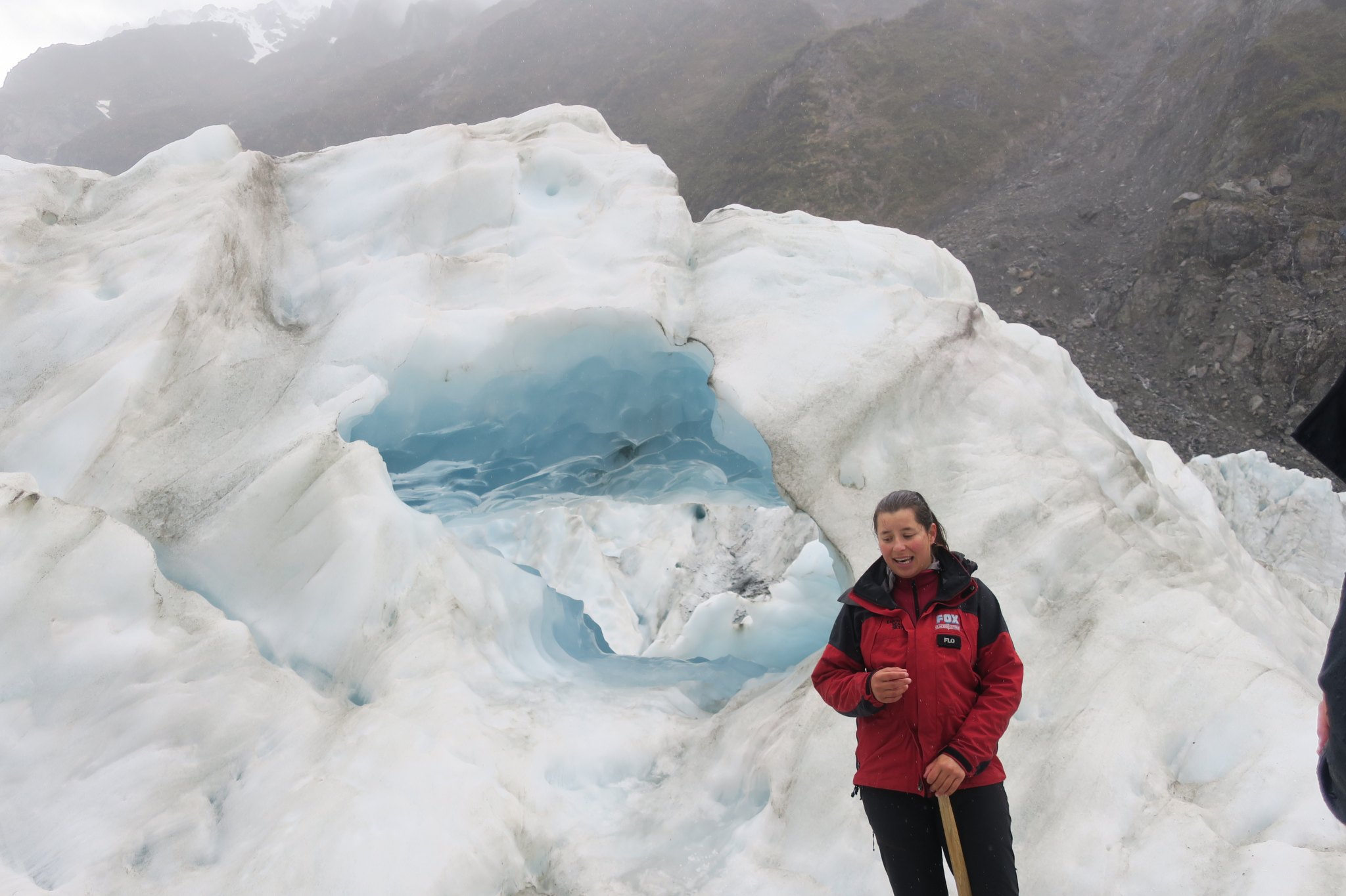
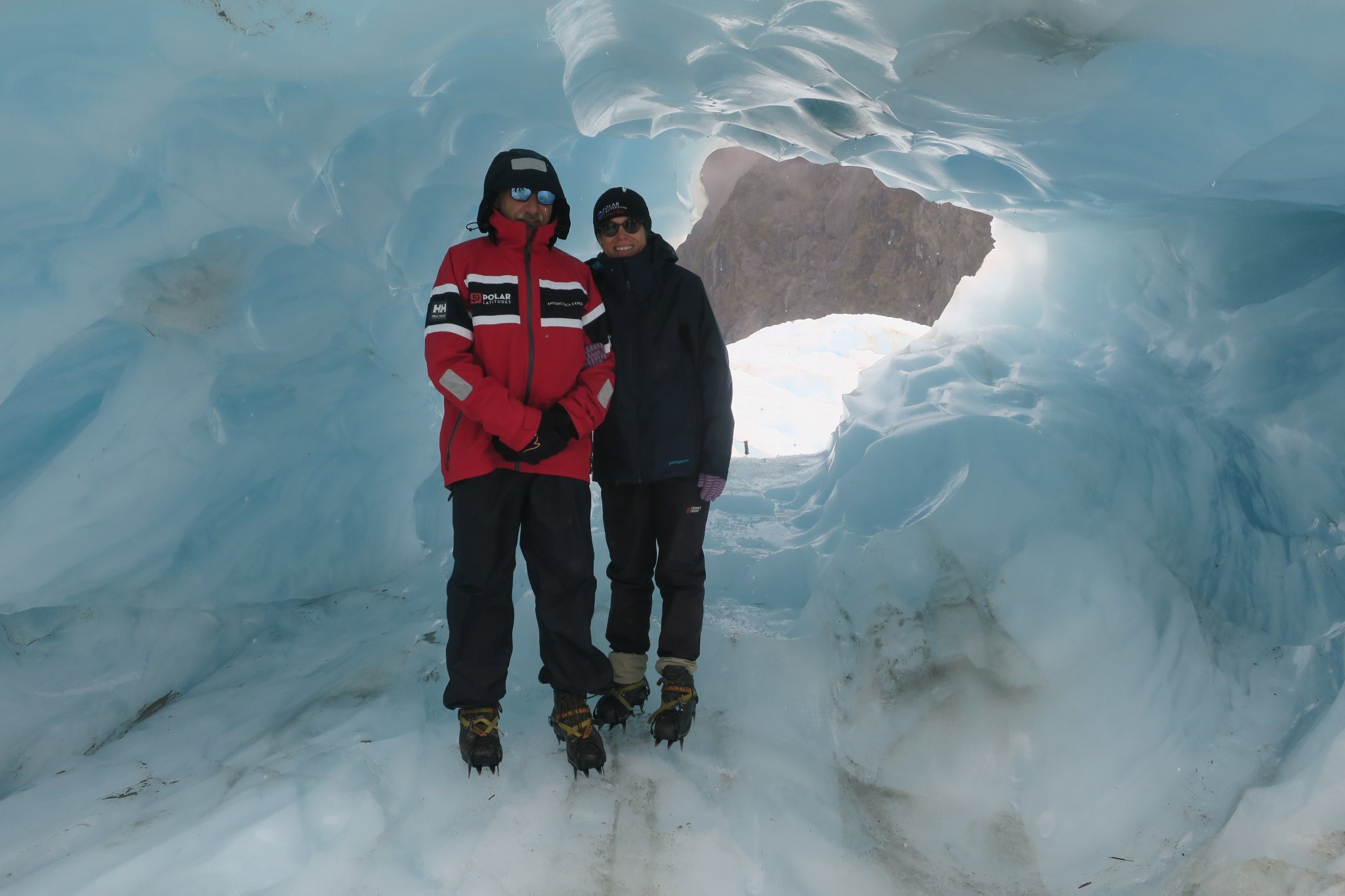
We were up early because we’re scheduled to go on the heli hike today. It was forecast to rain last night but I think we just got some sprinkles. This morning it was overcast and we really didn’t think we were going, but we went to the climbing center anyway. Guess what . . . it was on!. During our briefing it got more and more cloudy and I kept thinking they would cancel, but they didn’t. They gave us socks, boots and rain pants. Then we drove over to the helicopter pad. Rick and I were in the third group to head up. The helicopter was vibrating a lot during the 10 minute ride to the glacier. I didn’t like it , but obviously we made it. Once up there we met our guide Flo and she showed us how to put on our crampons and how to walk in them. There were only six of us in the group. We grabbed a walking stick and were off.
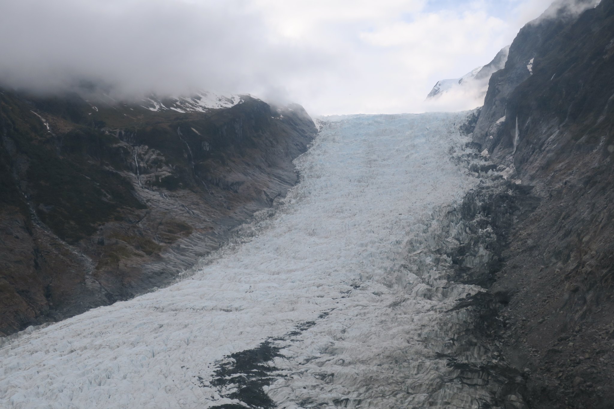
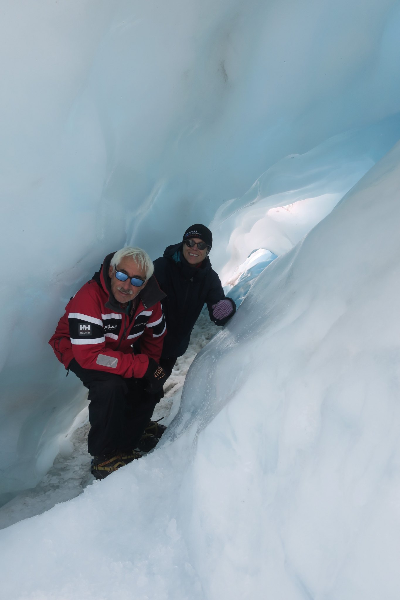
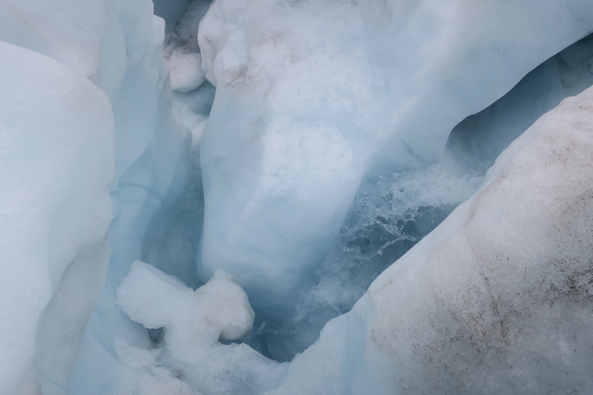
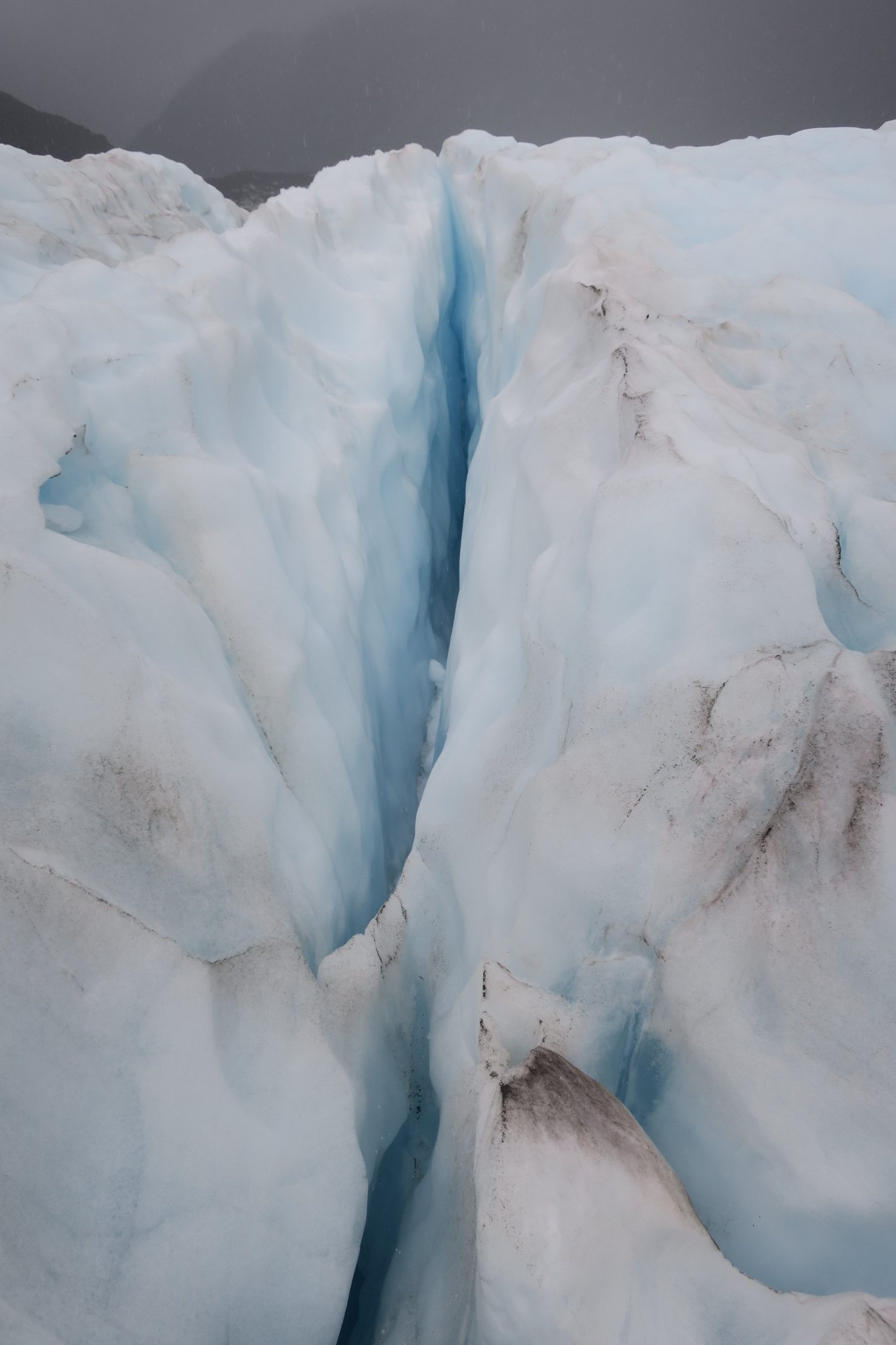
Flo lead the way with her ice axe. Often there were steps up the ice and she would chip away at them to make them flatter. Other times she used the axe to break off ice that could have broken away as we walked. We went quite a way up the glacier. She showed us crevices and moulins, vertical shafts in the glacier which were formed by surface water percolating through a crack in the ice. There were quite a few stream flowing because it was pretty warm, right above freezing. We went into several ice caves. It was beautiful and amazing. We both really enjoyed it and were so glad we’d made it up. We walked around the ice for about three hours. Once we were used to the crampons it was pretty easy to move about. Of course we couldn’t wander on our own because we could fall into a crevice or a moulin. Here are some interesting facts
It takes a snow flake that lands on the top of the glacier 50 years to reach the bottom.
The glacier is moving 3-5 meters per year.
Hiking on the glacier does not damage it but the helicopter does
32% of the land in New Zealand is designated as a national park
Our guide Flo
After exploring the ice we returned to the heli pad, but the clouds/fog had come in and the helicopter couldn’t fly up to get us. The company stores tents, sleeping bags, and food on the glacier in case people get stuck there. I believe last year people got stuck on the ice overnight five times. I was hoping we would get stuck but other people in our group had flights to catch so it was just as well that the helicopter arrived after a 15 minute wait.
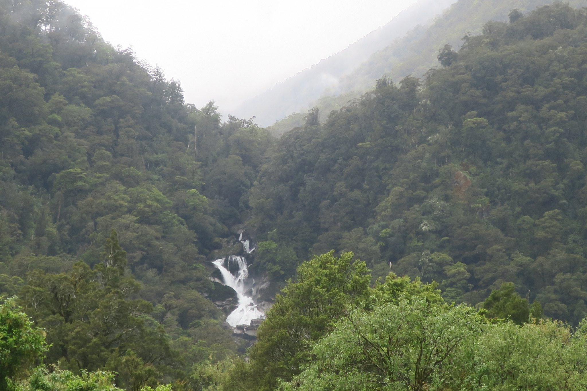
Once back at the climbing center we had some lunch in the camper and then started our journey to Queenstown. It was raining by then and the road was very windy. Most of the views were obscured by clouds and fog. There were a lot of waterfalls along the way. Also there were a lot more sheep and lambs as we got closer to Queenstown. There were very few sheep and cattle on the west coast which is actually classified as a rain forest. We managed to get a couple of good pictures.
We spent the night in Queenstown. We didn’t get there until about 6:30, so when we pulled into our favorite company’s campground and it was full. We headed down the street (literally about 3 miles ) and found a spot at another campground. It made us appreciate our favorite company because this campground is wall to wall campers. Not very nice. We had dinner in the camper. That evening we did a little the planning for the next several days and booked a day cruise through Doubtful Sound.
Not the most exciting day. We left Greymouth and as usual we hit the grocery store on the way out of town. We had booked the 2:30 heli hike tour on Franz Josef Glacier yesterday so we needed to be in Franz Josef by about noon.
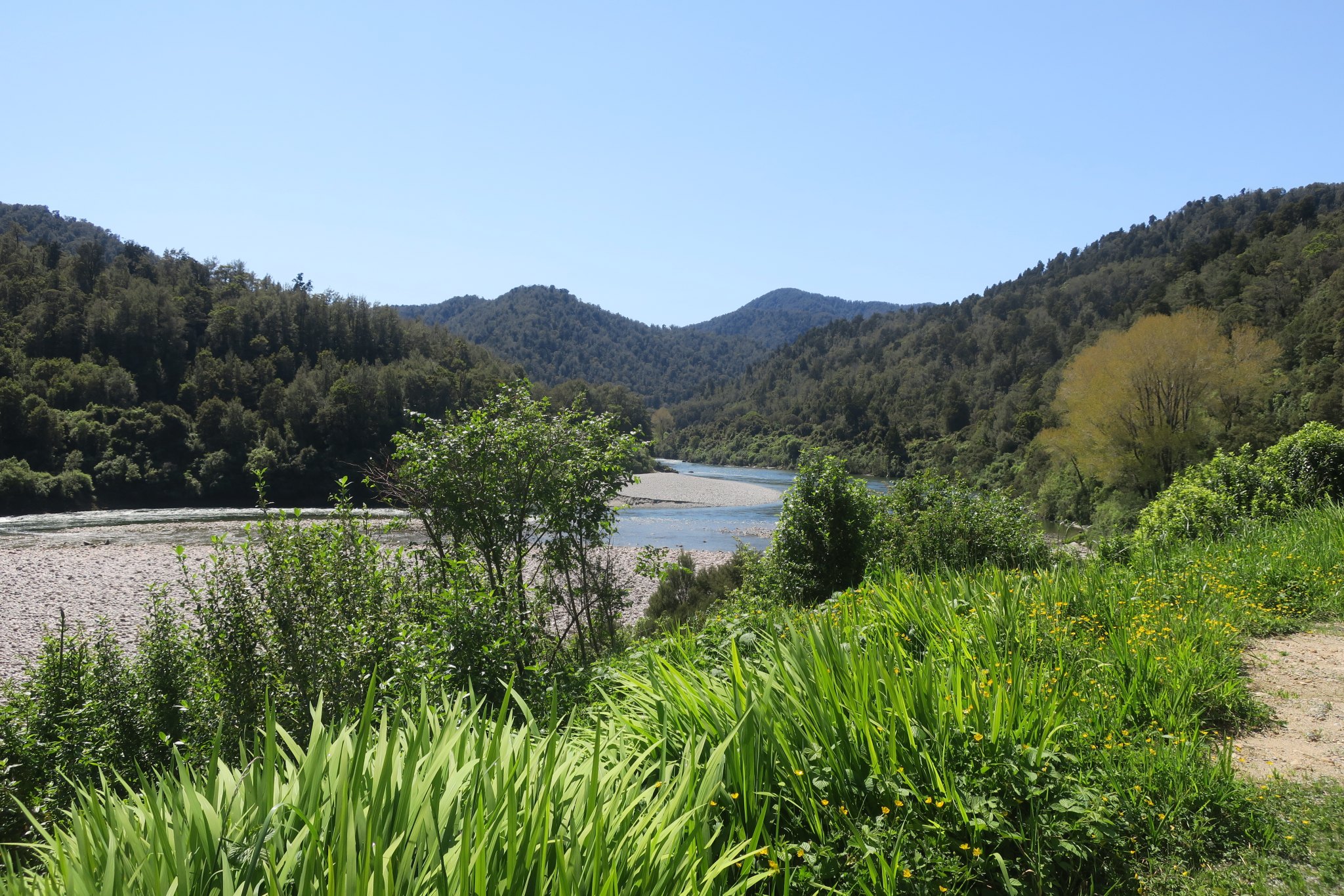
We drove down the coast. The next town down from Greymouth is Hokitika so we stopped there for breakfast. Rick had coffee in a small town restaurant. Across the street was the Carnegie Library. We asked who Carnegie was and, somewhat surprisingly, it turned out to be Andrew Carnegie. In his time he funded libraries all over the world, including in New Zealand.
After breakfast we went to a pounamu shop. Pounamu or New Zealand greenstone is found in this area. It was highly valued by the Maori people for making tools. They had a lot of beautiful pieces including a 4 inch statue that we really liked. We asked the price and it was about $3,500. Needless to say, it won’t be coming home with us.
We left Hokitika and continued on our way. We had not made specific plan for the North Island portion of our trip. We like the campervan life so much we tried to find one for our time on the North Island, but at this late date we couldn’t seem to find a thing. Over the past couple of days we had sent out a couple of emails to van brokers. One of them called while we were driving. She had a van just like the one we have now available for pickup in Auckland! We told her we would take it!
We arrived in Franz Josef around noon and checked in at the heli hike company. They monitor the weather very closely and cancel the flight if the weather doesn’t look good. As of noon we were still on so we had some lunch and went back to the checkin site. We were given a number and sent into the “boot room”. About a half hour before we were scheduled to take off the flight was canceled. We weren’t surprised because other companies in the area were also canceling flights. We were disappointed. The heli hike was going to be one of the highlights of our trip. They were willing to reschedule us for following day, but the weather didn’t look much better. We decided we would spend the night a little further south so we got back in the camper and drove south. We have been consistently staying at Top10 Holiday Parks and the next park was in Fox Glacier.
I asked about heli hikes on Fox Glacier and they had two openings on the 7:50am flights, so we figured we’d take them. If we get to go up fantastic, if it’s raining as forecasted nothing lost. We will see what happens tomorrow.
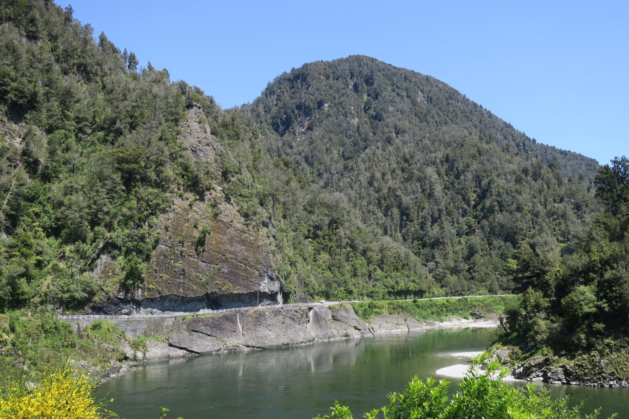
We started our day by stopping at a great European bakery and going to the grocery store. We hit the road and stopped several times to take pictures.
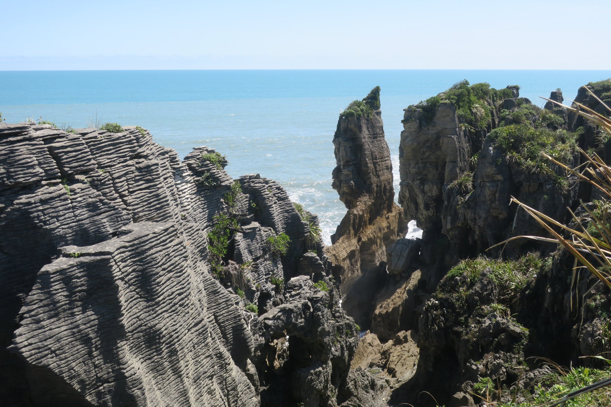
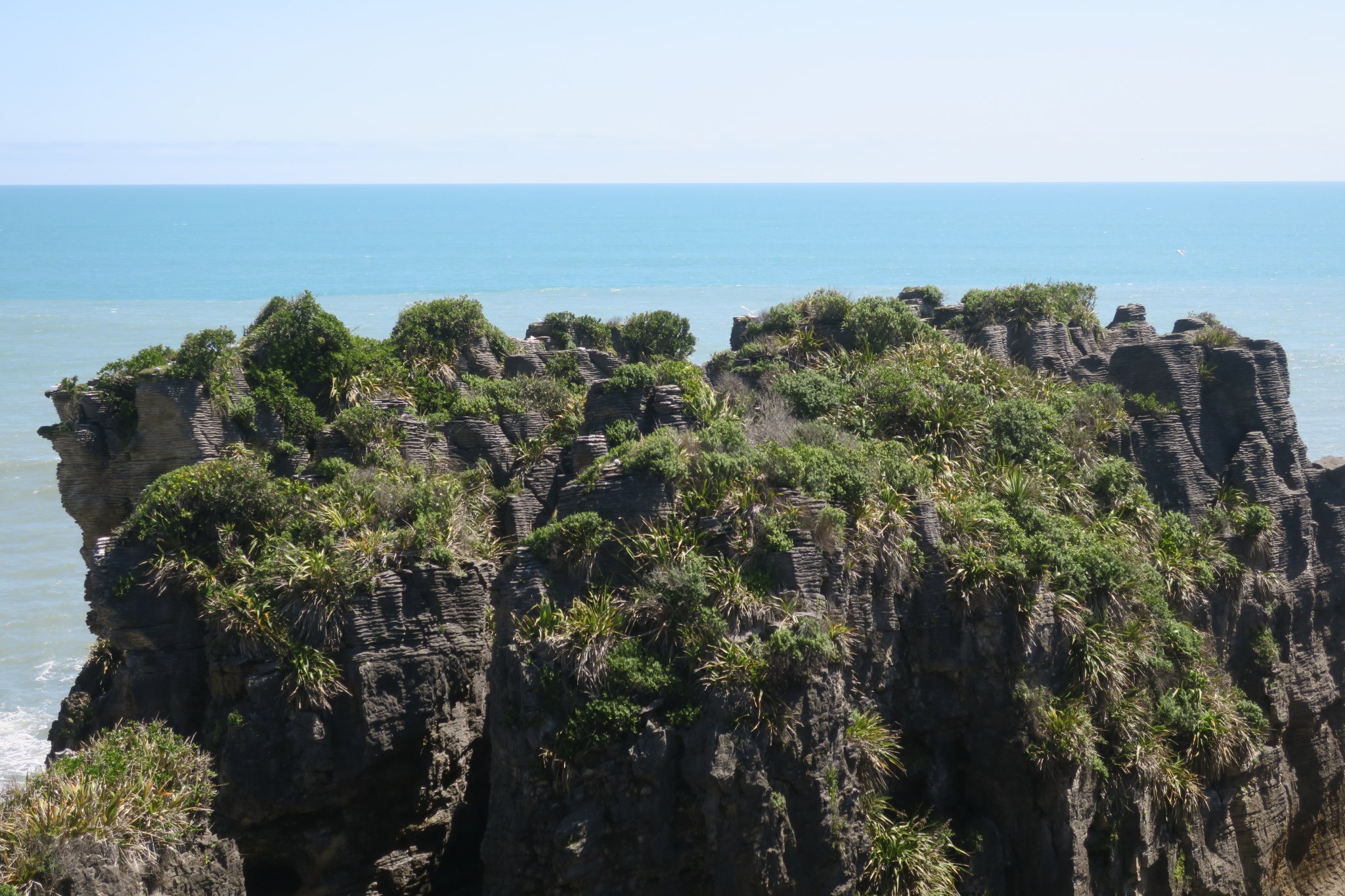
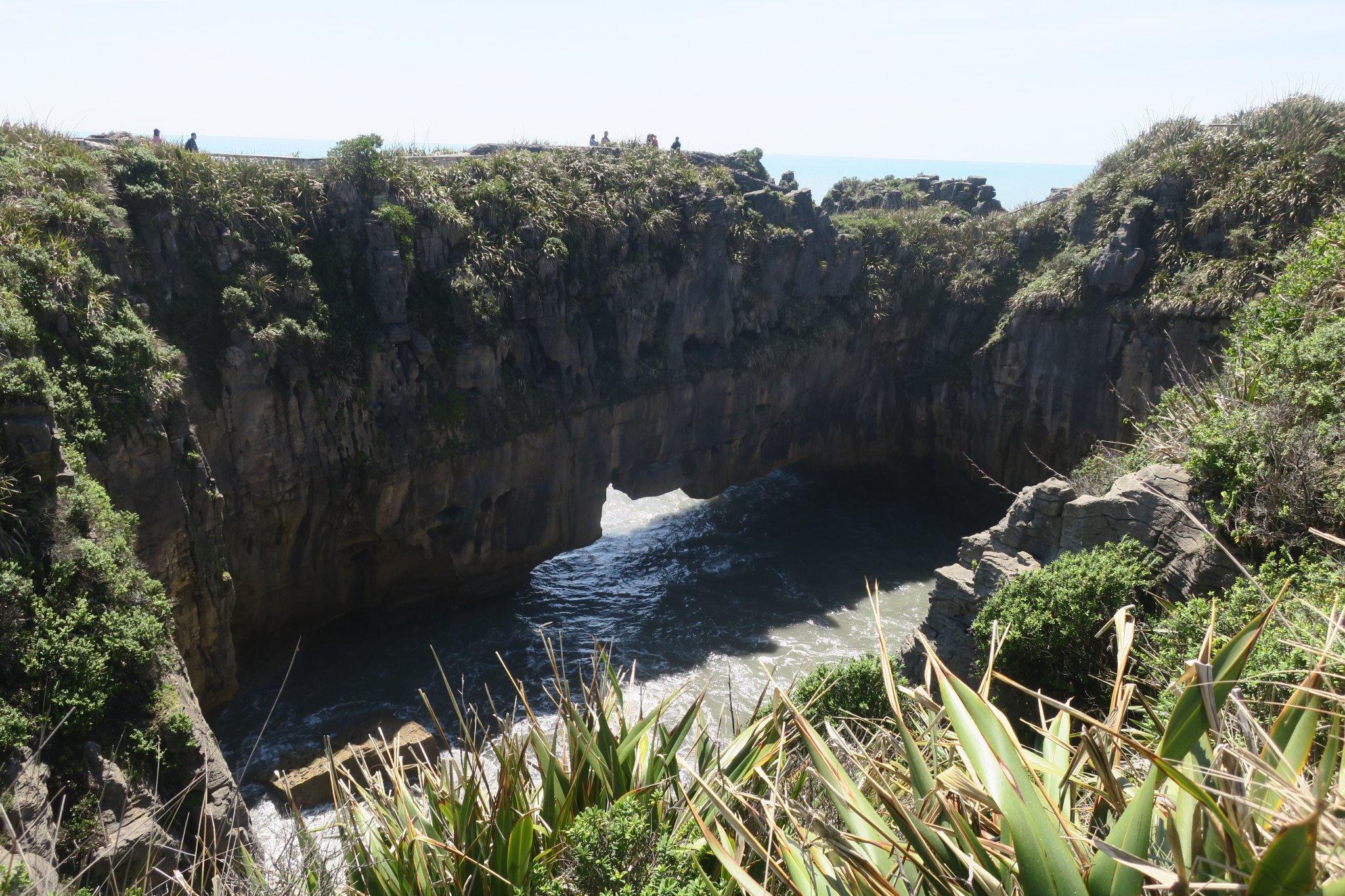
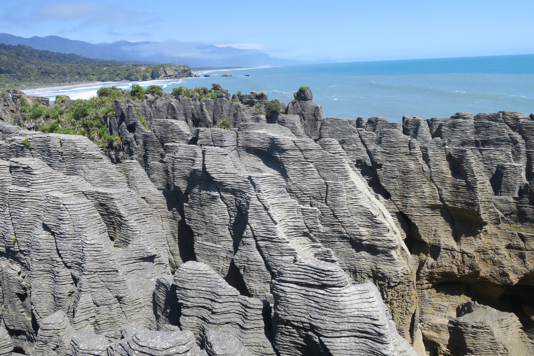
Around 1:00 PM we arrived in Punakaiki, the location of the pancake rocks. Our guide book states that “The huge swells that batter this coast have eroded the limestone cliffs, carving them into fantastical shapes.” According to the park signs scientists have theories about how the layered rocks were formed, but have not proven them. Rather than try to describe them a picture is worth a thousand words.
After exploring the pancake rocks we continued on to Greymouth where we planned to spend the night. We found our campground and got situated. I made reservations for tomorrow’s heli Hike on a glacier while Rick made hamburgers for dinner.
We spent the evening getting caught up on the blog.
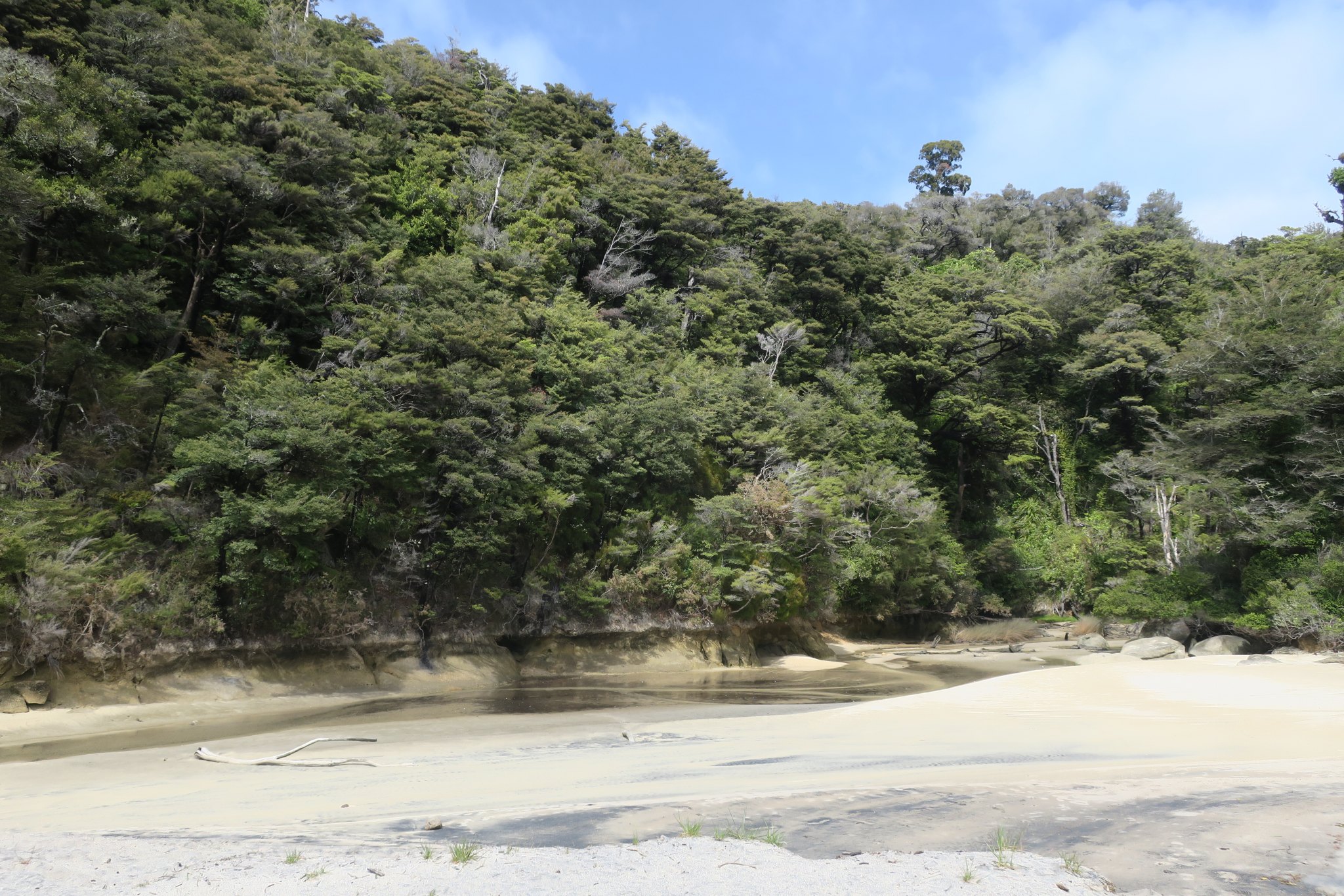
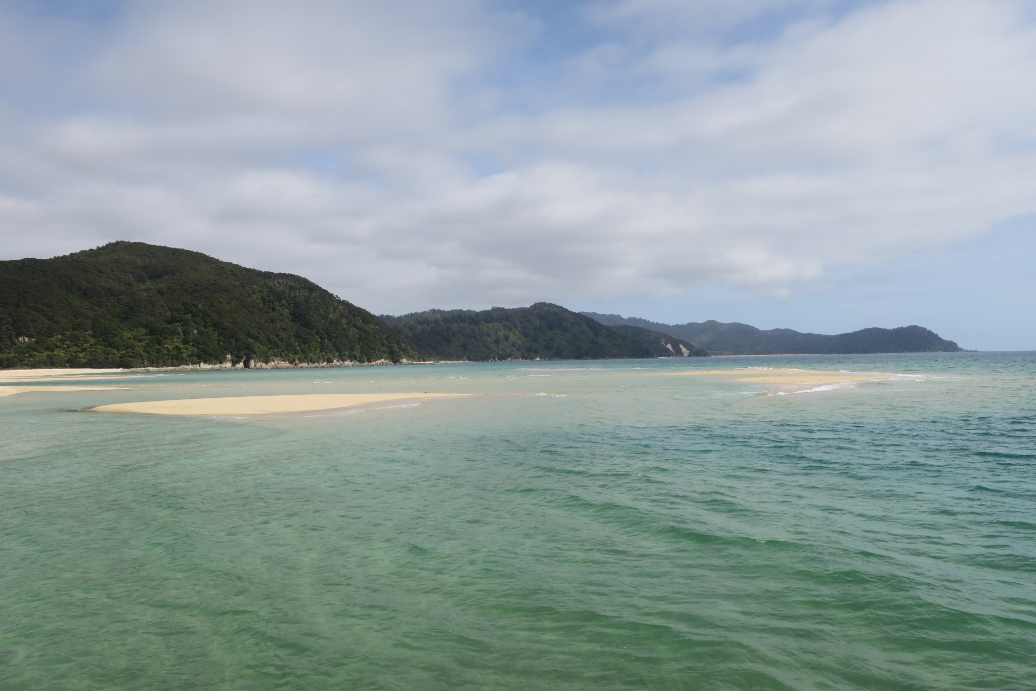
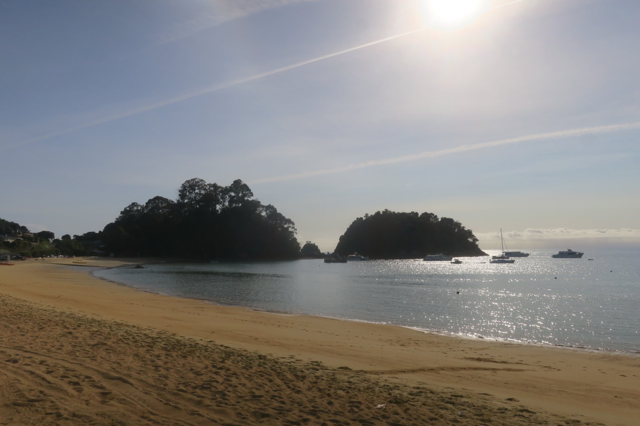
Today we’re going to Abel Tasman National Park which is in the middle of the northern coast. Abel Tasman National Park only has a couple of roads through the center of it. It is know for its spectacular golden beaches which can only be reached by boat. The beaches are golden in color because they are high in iron which leeches out of the rock and turns to rust.
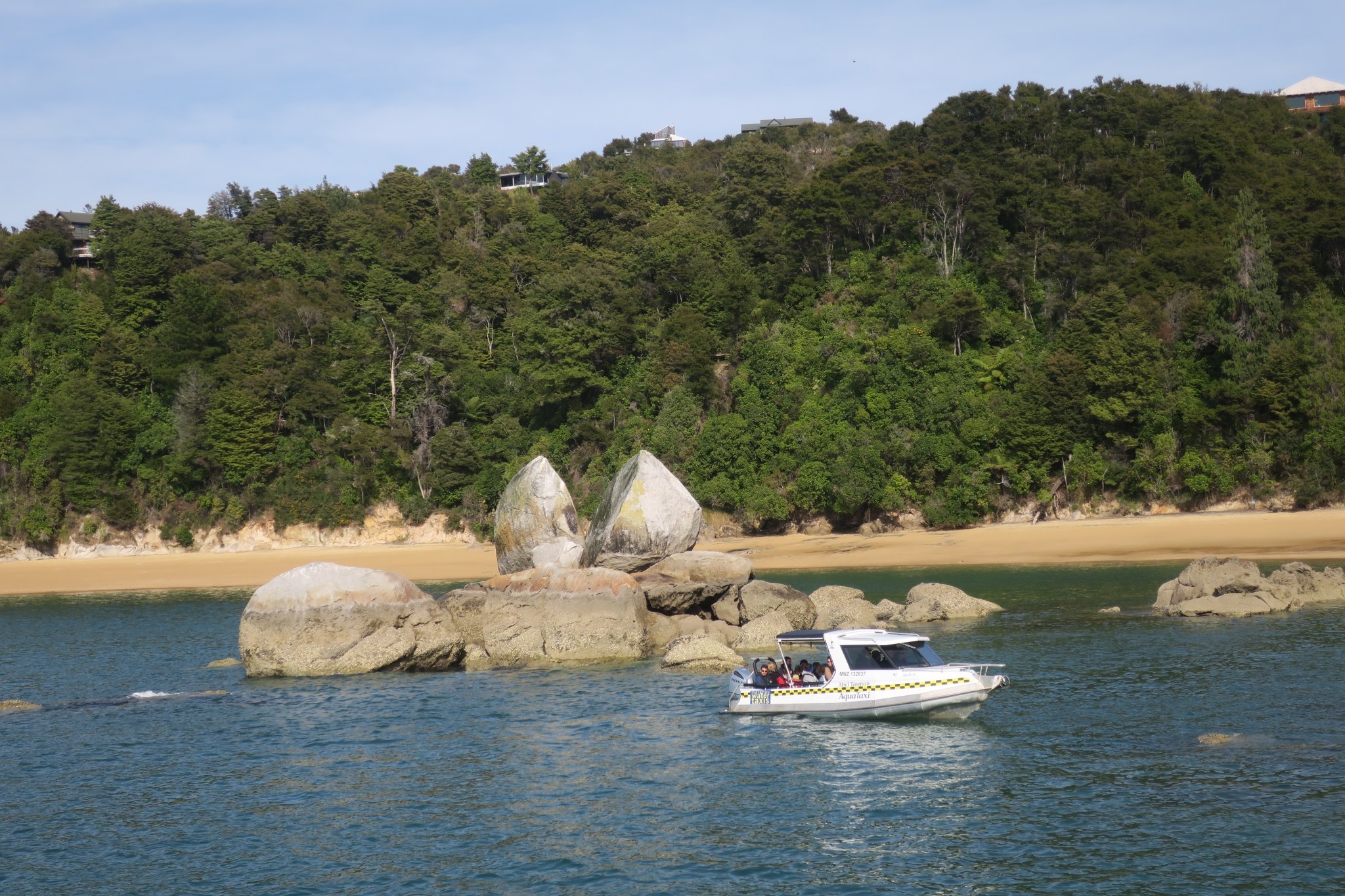
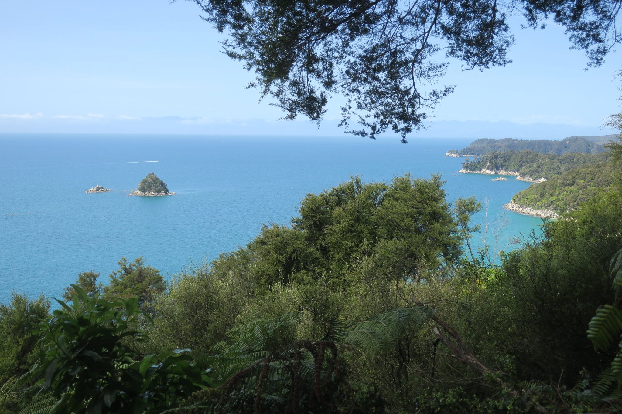
We were picked up at the campground at 8:20 and driven to Kaiteriteri where we boarded a catamaran. We sat on the top deck for most of the ride until it got too cold. We motored along the coast and our first “stop” (you can’t get off the boat here so we just motored around) was Split Apple Rock which looks like . . . wait for it . . . a split apple.
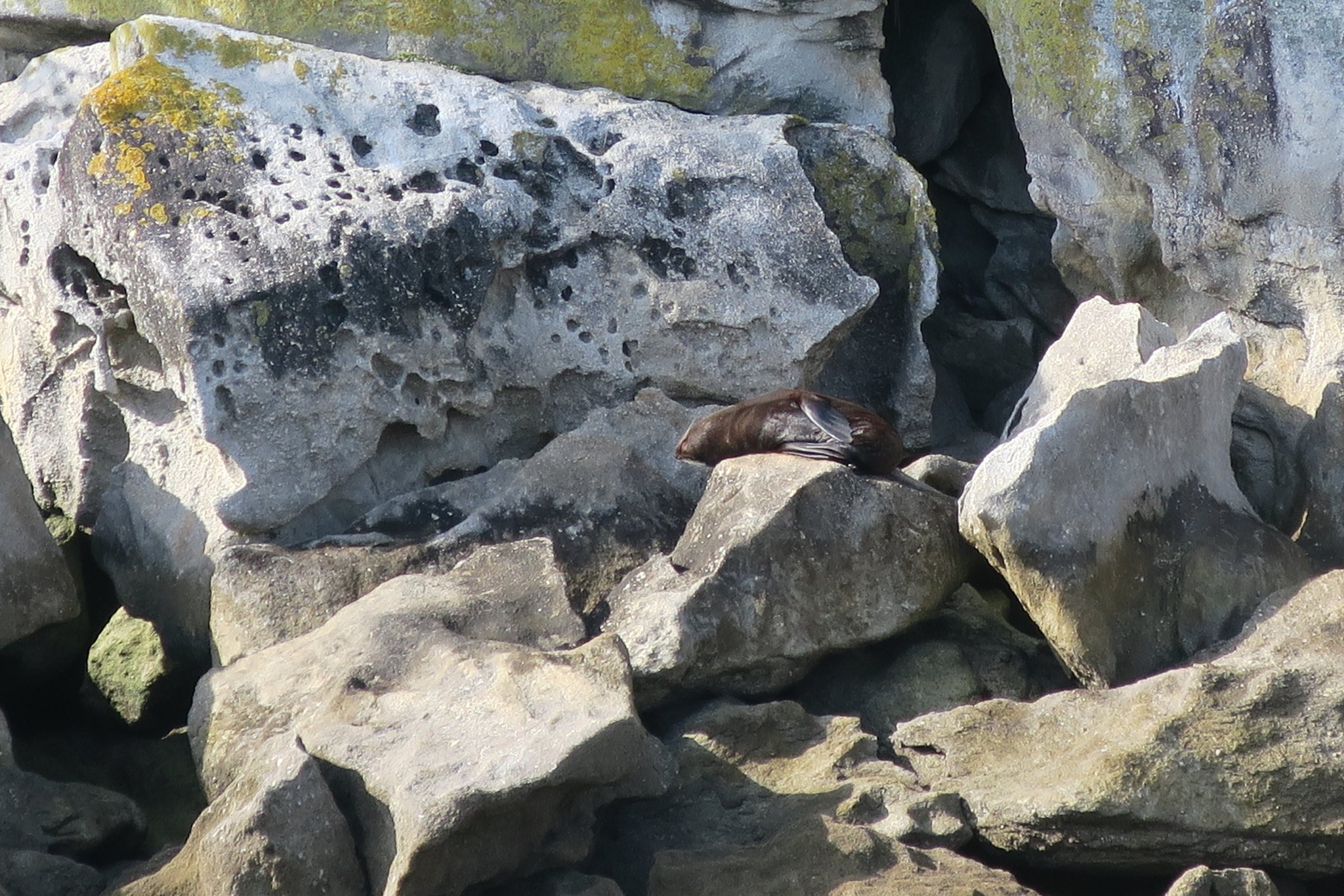
Then we continued up the coast stopping a various bays to let people off. Along the way we stopped at Adele Island to see the seals sunbathing.
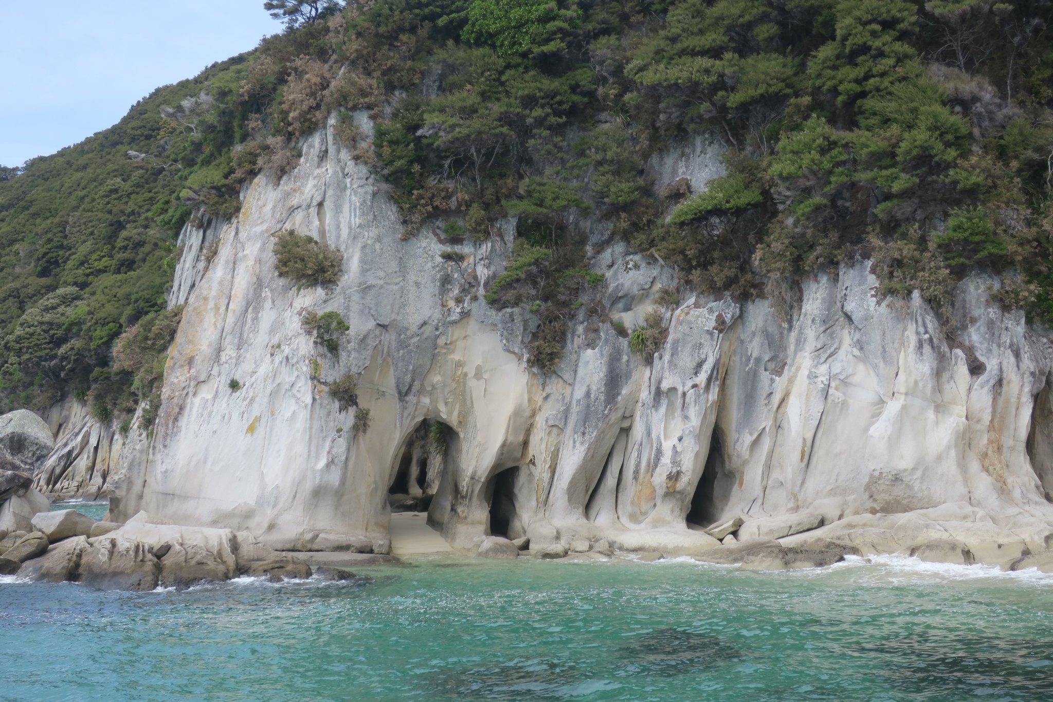
We went all the way to the last bay in the park, Totaranui, where we turned around and headed back the way we came. On the way we stopped at the Tonga Arches, natural rock arches which you can kayak through in high tide or stand on a sandy beach in low tide.
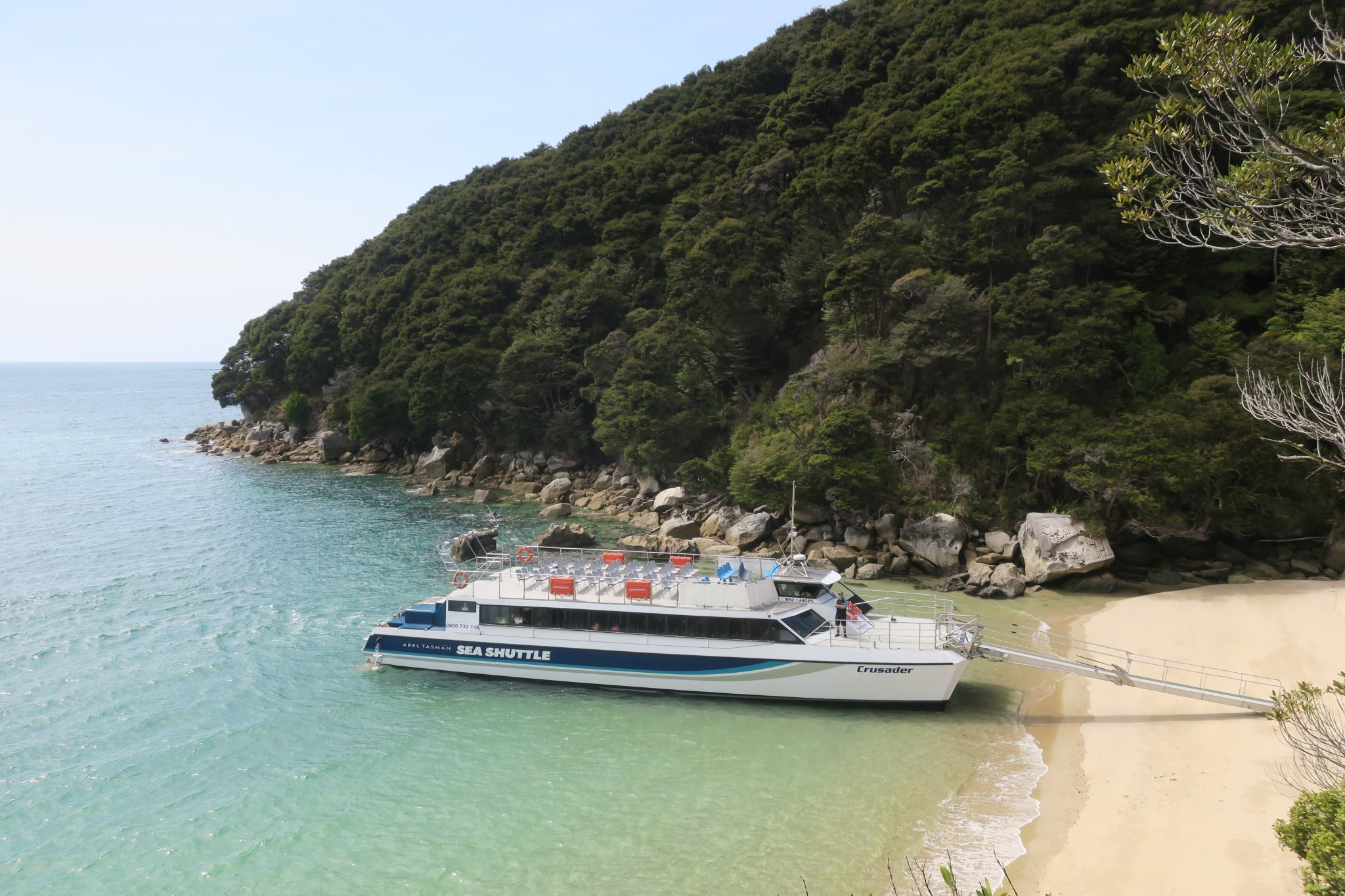
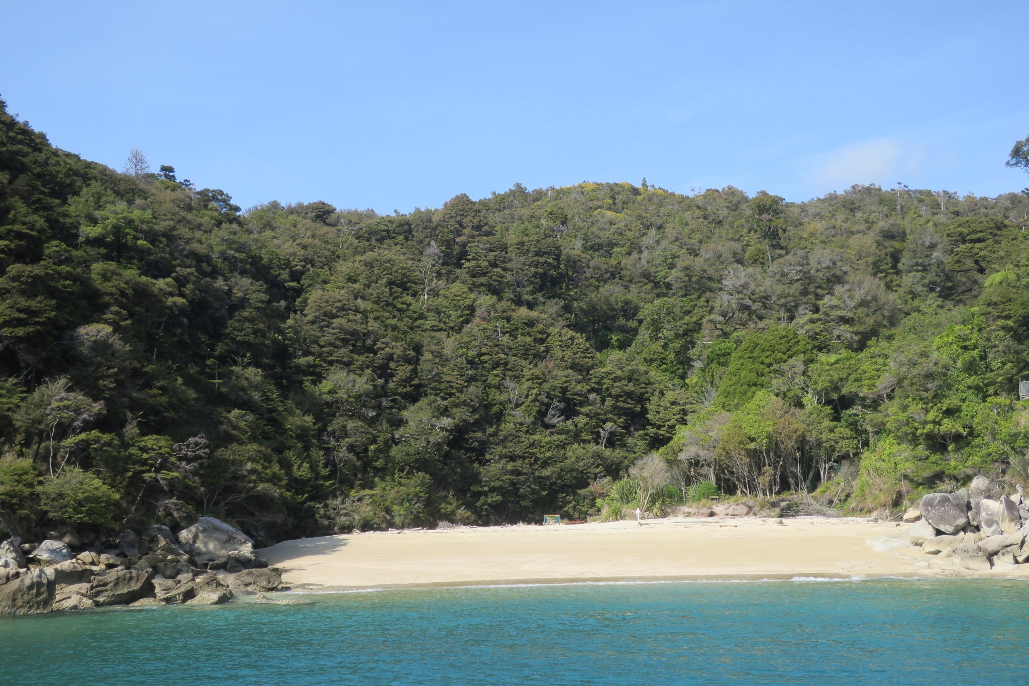
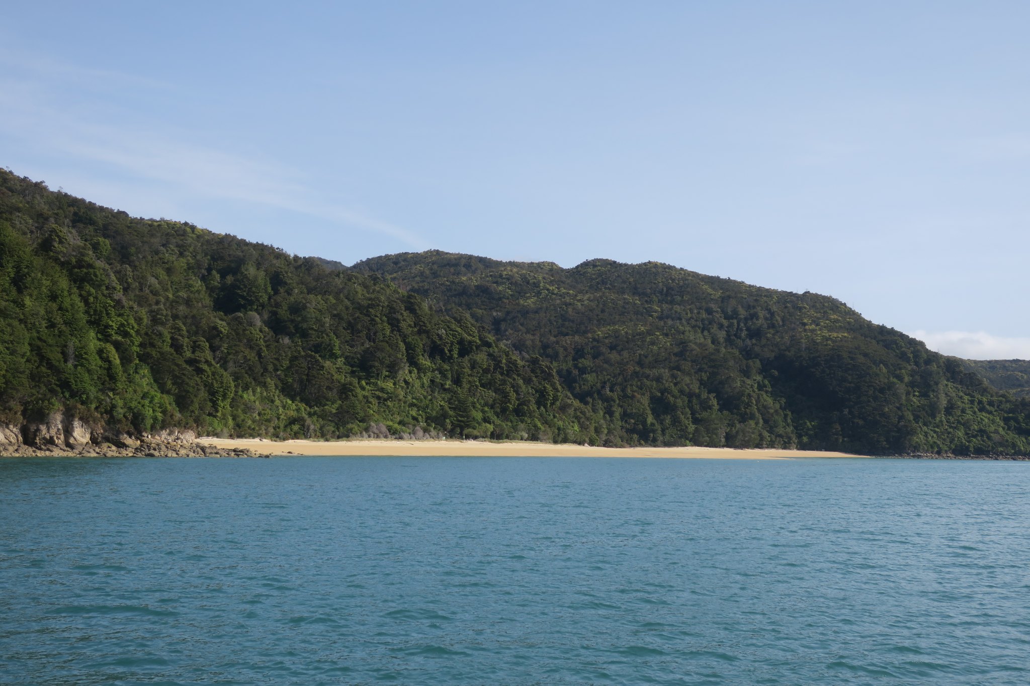
We were dropped at Medlands Beach at 11:30 and started our hike. This is our boat dropping us off.
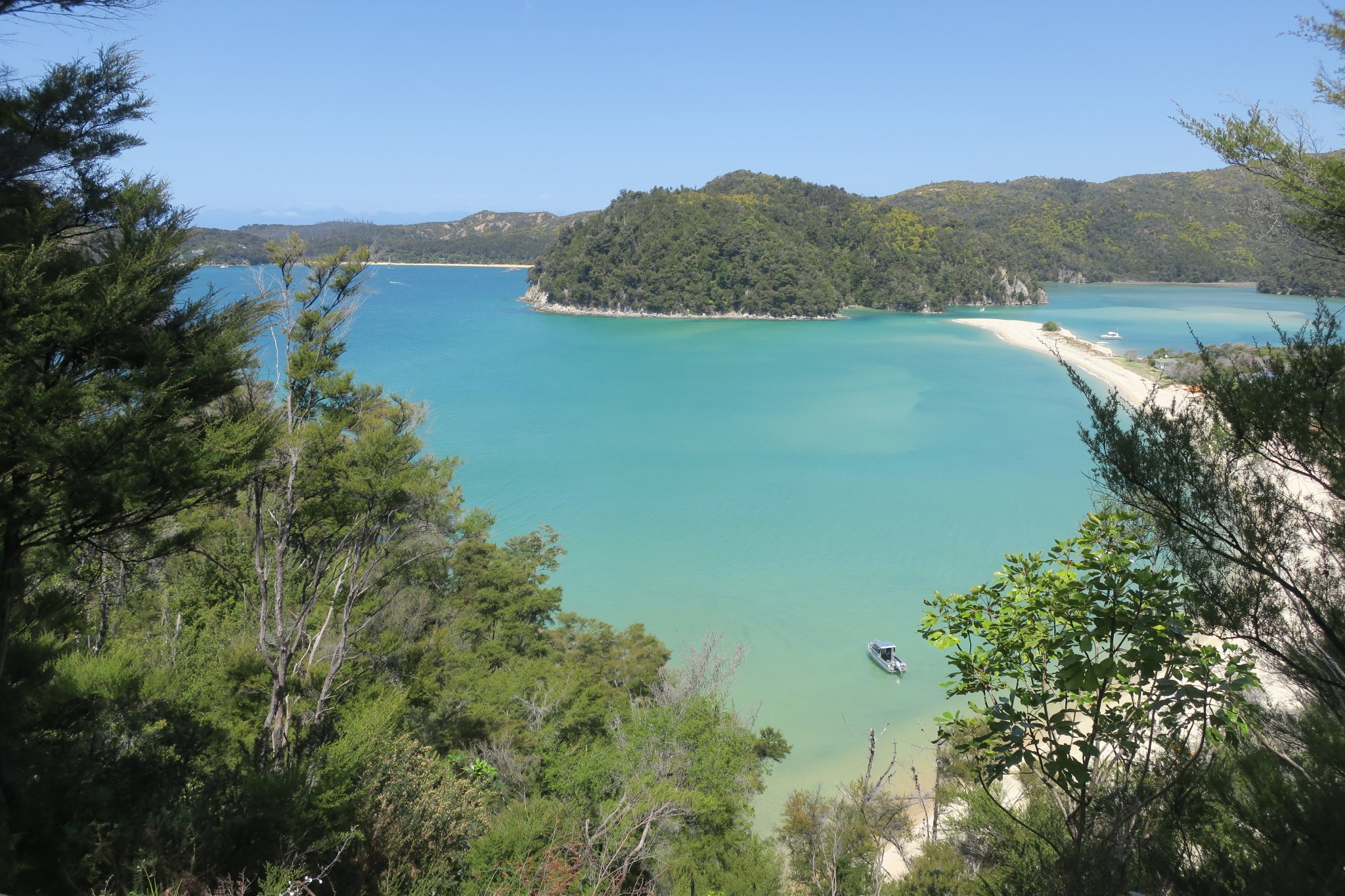
We expected to be walking along the beach but actually walked uphill to a dense forested path. Initially we were going up and down but eventually it was mostly flat. We were talking to people along the way. It was very beautiful.
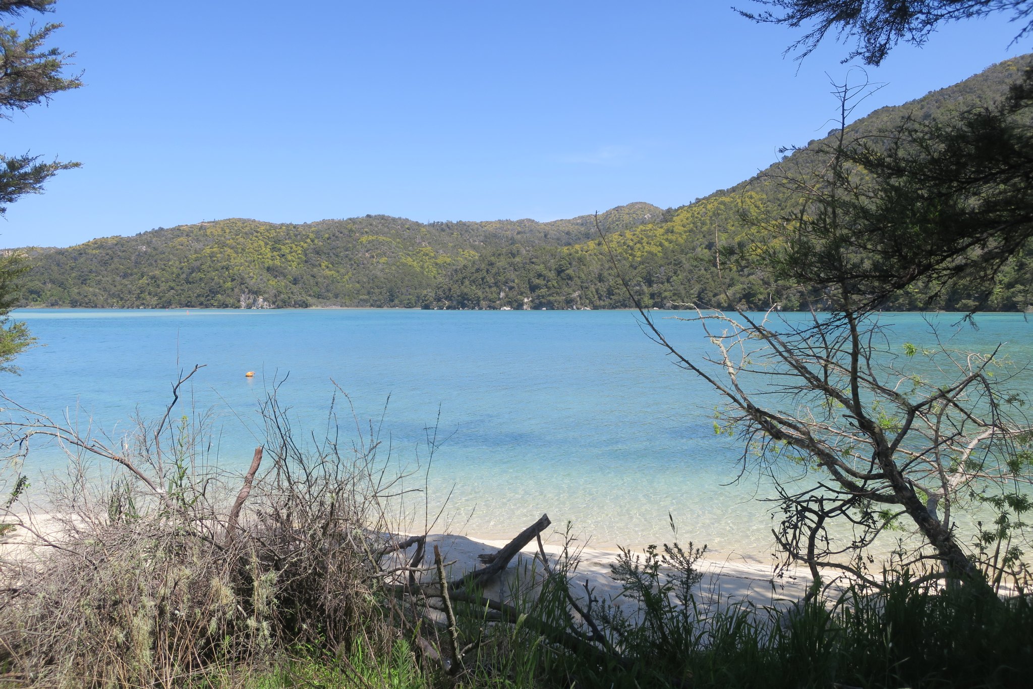
We stopped for our box lunches (provided by the boat) overlooking an amazing bay.
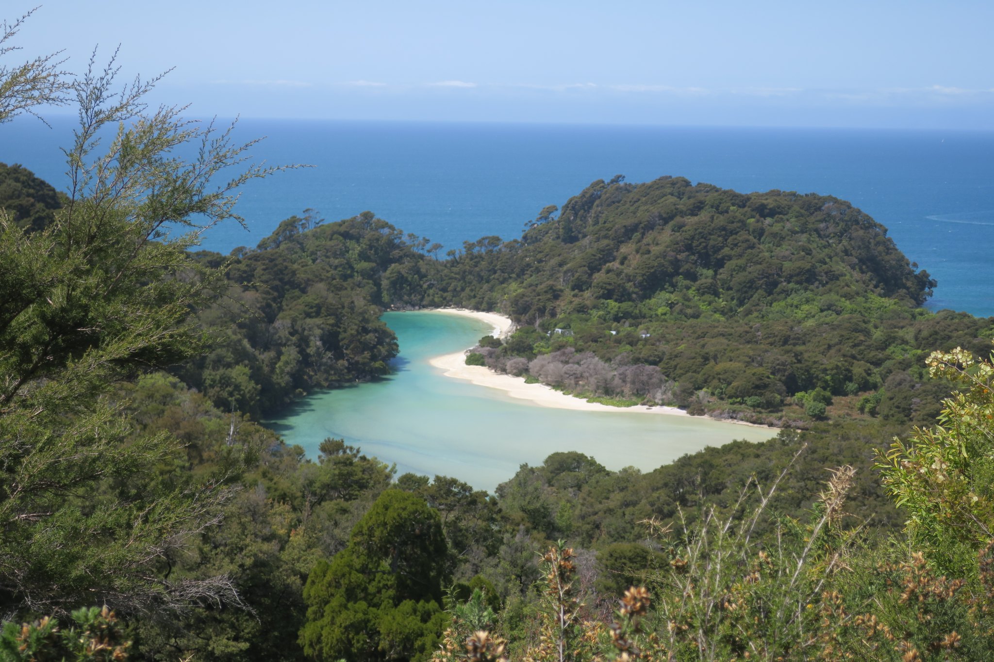
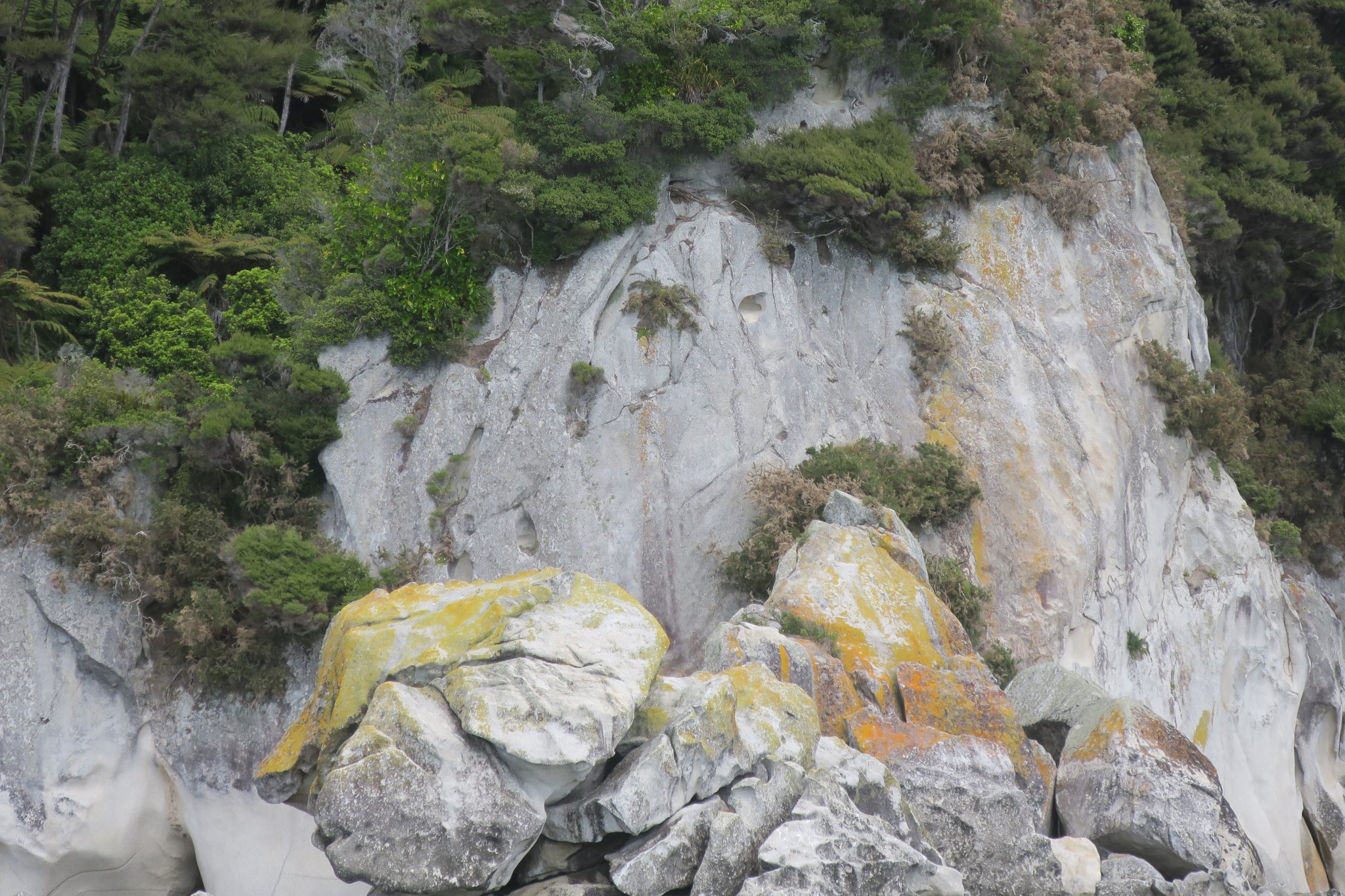
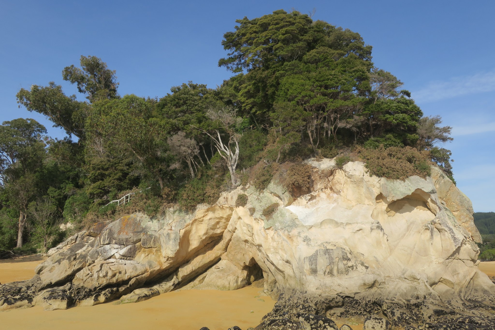
We ate with people we met on the trail who were from southern California. After lunch we came to a sign saying we had two more hours of hiking to get to the bay where we were to be picked up. It was exactly two hours before our pick up time. We weren’t sure what would happen if we weren’t there on time and we sure didn’t want to find out, so we started hustling. We bypassed a short walk to Cleopatra’s Pool and made it to the designated stop in Anchorage Bay about a half hour before the boat was scheduled to arrive. Phew! All told it took us 3 ¾ hr to walk 8 miles. Here are some of our best pictures from the boat ride and the walk.
The boat was on time and it seemed that everyone was there. It was a short ride back to Kaiteriteri where we caught the bus that took us back to the campground. On the bus we passed many fields of kiwis and hopps. The kiwis were behind wind breaks to protect their delicate leaves. We’ve seen a lot of hedges that were groomed into wind breaks. The hopps vines were coaxed to grow up a line and grow very fast this time of year. In the past tobacco was a popular crop, but locals stopped growing it because of the harmful effects of tobacco. In fact New Zealand is trying to outlaw all smoking by 2025.
That evening Rick cooked ginger pork on our outside grill. We were very tired after our walk and slept well.